You are here: Home > Network List > US - United States National Seismic Network Stations List
> Station MSO Missoula, Montana, USA > Earthquake Result Viewer
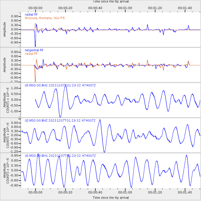
MSO Missoula, Montana, USA - Earthquake Result Viewer
*The percent match for this event was below the threshold and hence no stack was calculated.
| Earthquake location: |
West Chile Rise |
| Earthquake latitude/longitude: |
-34.9/-104.3 |
| Earthquake time(UTC): |
2023/12/07 (341) 01:17:44 GMT |
| Earthquake Depth: |
10 km |
| Earthquake Magnitude: |
5.8 Mww |
| Earthquake Catalog/Contributor: |
NEIC PDE/us |
|
| Network: |
US United States National Seismic Network |
| Station: |
MSO Missoula, Montana, USA |
| Lat/Lon: |
46.83 N/113.94 W |
| Elevation: |
1264 m |
|
| Distance: |
81.9 deg |
| Az: |
353.352 deg |
| Baz: |
172.039 deg |
| Ray Param: |
$rayparam |
*The percent match for this event was below the threshold and hence was not used in the summary stack. |
|
| Radial Match: |
59.523167 % |
| Radial Bump: |
400 |
| Transverse Match: |
76.9629 % |
| Transverse Bump: |
400 |
| SOD ConfigId: |
33232451 |
| Insert Time: |
2023-12-21 01:37:05.135 +0000 |
| GWidth: |
2.5 |
| Max Bumps: |
400 |
| Tol: |
0.001 |
|
Signal To Noise
| Channel | StoN | STA | LTA |
| US:MSO:00:BHZ:20231207T01:29:32.474007Z | 0.46285275 | 2.8239586E-7 | 6.101203E-7 |
| US:MSO:00:BH1:20231207T01:29:32.474007Z | 3.1131837 | 6.8793935E-7 | 2.2097615E-7 |
| US:MSO:00:BH2:20231207T01:29:32.474007Z | 0.17947468 | 1.2209918E-7 | 6.803142E-7 |
| Arrivals |
| Ps | |
| PpPs | |
| PsPs/PpSs | |


