You are here: Home > Network List > NE - New England Seismic Network Stations List
> Station EMMW Machias, ME, USA > Earthquake Result Viewer
EMMW Machias, ME, USA - Earthquake Result Viewer
*The percent match for this event was below the threshold and hence no stack was calculated.
| Earthquake location: |
Caspian Sea |
| Earthquake latitude/longitude: |
41.2/49.7 |
| Earthquake time(UTC): |
2023/12/07 (341) 04:15:40 GMT |
| Earthquake Depth: |
42 km |
| Earthquake Magnitude: |
5.4 Mww |
| Earthquake Catalog/Contributor: |
NEIC PDE/us |
|
| Network: |
NE New England Seismic Network |
| Station: |
EMMW Machias, ME, USA |
| Lat/Lon: |
44.71 N/67.46 W |
| Elevation: |
35 m |
|
| Distance: |
77.7 deg |
| Az: |
319.519 deg |
| Baz: |
43.431 deg |
| Ray Param: |
$rayparam |
*The percent match for this event was below the threshold and hence was not used in the summary stack. |
|
| Radial Match: |
72.16794 % |
| Radial Bump: |
400 |
| Transverse Match: |
54.35635 % |
| Transverse Bump: |
400 |
| SOD ConfigId: |
33232451 |
| Insert Time: |
2023-12-21 04:40:33.380 +0000 |
| GWidth: |
2.5 |
| Max Bumps: |
400 |
| Tol: |
0.001 |
|
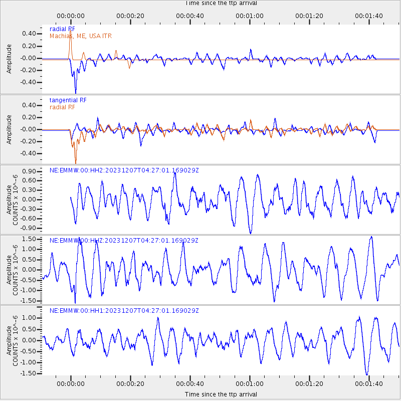
Signal To Noise
| Channel | StoN | STA | LTA |
| NE:EMMW:00:HHZ:20231207T04:27:01.169029Z | 2.1307118 | 9.2286894E-7 | 4.3312707E-7 |
| NE:EMMW:00:HH1:20231207T04:27:01.169029Z | 0.9077306 | 3.6315737E-7 | 4.0007177E-7 |
| NE:EMMW:00:HH2:20231207T04:27:01.169029Z | 1.4256446 | 4.4556083E-7 | 3.1253288E-7 |
| Arrivals |
| Ps | |
| PpPs | |
| PsPs/PpSs | |


