
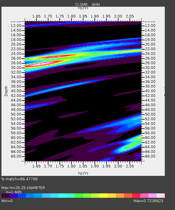
GMR Granite Mountains Research Center - Earthquake Result Viewer
| ||||||||||||||||||
| ||||||||||||||||||
| ||||||||||||||||||
|
Signal To Noise
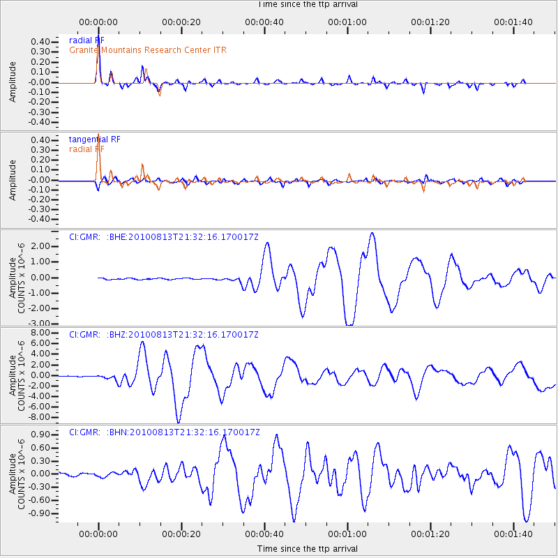
| Channel | StoN | STA | LTA |
| CI:GMR: :BHZ:20100813T21:32:16.170017Z | 11.348948 | 5.466046E-7 | 4.8163464E-8 |
| CI:GMR: :BHN:20100813T21:32:16.170017Z | 0.90568876 | 4.7871904E-8 | 5.28569E-8 |
| CI:GMR: :BHE:20100813T21:32:16.170017Z | 4.0485554 | 1.6979035E-7 | 4.1938502E-8 |
| Arrivals | |
| Ps | 3.1 SECOND |
| PpPs | 12 SECOND |
| PsPs/PpSs | 15 SECOND |

