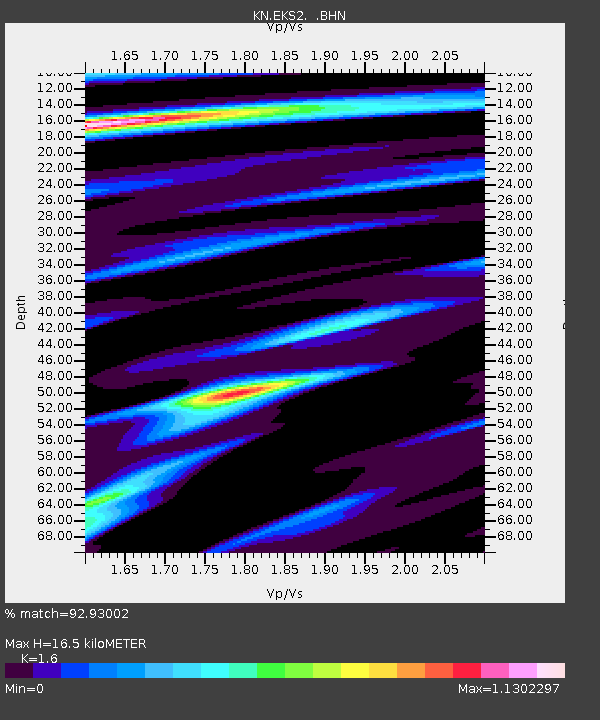
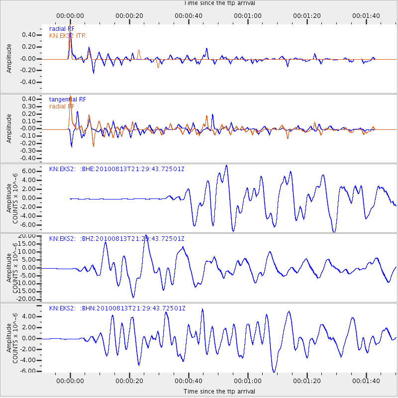
EKS2 KN.EKS2 - Earthquake Result Viewer

Earthquake location: South Of Mariana Islands
Earthquake latitude/longitude: 12.5/141.5
Earthquake time(UTC): 2010/08/13 (225) 21:19:33 GMT
Earthquake Depth: 10 km
Earthquake Magnitude: 6.5 MB, 6.9 MS, 6.9 MW, 6.9 MW
Earthquake Catalog/Contributor: WHDF/NEIC
Network: KN Kyrgyz Seismic Telemetry Network
Station: EKS2 KN.EKS2
Lat/Lon: 42.66 N/73.78 E
Elevation: 1360 m
Distance: 65.3 deg
Az: 311.289 deg
Baz: 95.801 deg
Ray Param: 0.058384806
Estimated Moho Depth: 16.5 km
Estimated Crust Vp/Vs: 1.60
Assumed Crust Vp: 6.316 km/s
Estimated Crust Vs: 3.947 km/s
Estimated Crust Poisson's Ratio: 0.18
Radial Match: 92.93002 %
Radial Bump: 400
Transverse Match: 93.624664 %
Transverse Bump: 400
SOD ConfigId: 319893
Insert Time: 2011-01-05 21:23:09.215 +0000
GWidth: 2.5
Max Bumps: 400
Tol: 0.001

Signal To Noise

ChannelStoNSTALTA
KN:EKS2: :BHZ:20100813T21:29:43.72501Z12.3524137.462549E-76.04137E-8
KN:EKS2: :BHN:20100813T21:29:43.72501Z1.63053856.939792E-84.256135E-8
KN:EKS2: :BHE:20100813T21:29:43.72501Z8.2967513.101057E-73.737676E-8
Arrivals
Ps1.6 SECOND
PpPs6.5 SECOND
PsPs/PpSs8.1 SECOND