You are here: Home > Network List > UW - Pacific Northwest Regional Seismic Network Stations List
> Station FISH Seaside, OR, USA > Earthquake Result Viewer
FISH Seaside, OR, USA - Earthquake Result Viewer
*The percent match for this event was below the threshold and hence no stack was calculated.
| Earthquake location: |
South Of Mariana Islands |
| Earthquake latitude/longitude: |
12.5/141.5 |
| Earthquake time(UTC): |
2010/08/13 (225) 21:19:33 GMT |
| Earthquake Depth: |
10 km |
| Earthquake Magnitude: |
6.5 MB, 6.9 MS, 6.9 MW, 6.9 MW |
| Earthquake Catalog/Contributor: |
WHDF/NEIC |
|
| Network: |
UW Pacific Northwest Regional Seismic Network |
| Station: |
FISH Seaside, OR, USA |
| Lat/Lon: |
45.93 N/123.56 W |
| Elevation: |
325 m |
|
| Distance: |
84.6 deg |
| Az: |
44.304 deg |
| Baz: |
282.204 deg |
| Ray Param: |
$rayparam |
*The percent match for this event was below the threshold and hence was not used in the summary stack. |
|
| Radial Match: |
48.727768 % |
| Radial Bump: |
400 |
| Transverse Match: |
42.343422 % |
| Transverse Bump: |
400 |
| SOD ConfigId: |
319893 |
| Insert Time: |
2011-01-05 21:34:27.835 +0000 |
| GWidth: |
2.5 |
| Max Bumps: |
400 |
| Tol: |
0.001 |
|
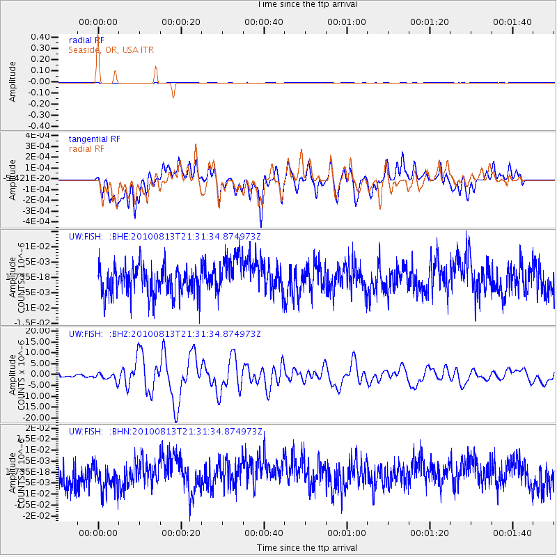
Signal To Noise
| Channel | StoN | STA | LTA |
| UW:FISH: :BHZ:20100813T21:31:34.874973Z | 3.0749004 | 1.8793379E-6 | 6.111866E-7 |
| UW:FISH: :BHN:20100813T21:31:34.874973Z | 1.2785683 | 7.849007E-9 | 6.138903E-9 |
| UW:FISH: :BHE:20100813T21:31:34.874973Z | 1.5823678 | 7.113245E-9 | 4.495317E-9 |
| Arrivals |
| Ps | |
| PpPs | |
| PsPs/PpSs | |


