You are here: Home > Network List > CN - Canadian National Seismograph Network Stations List
> Station INK INUVIK, NT > Earthquake Result Viewer
INK INUVIK, NT - Earthquake Result Viewer
*The percent match for this event was below the threshold and hence no stack was calculated.
| Earthquake location: |
Vanuatu Islands |
| Earthquake latitude/longitude: |
-20.7/169.2 |
| Earthquake time(UTC): |
2023/12/07 (341) 12:56:30 GMT |
| Earthquake Depth: |
48 km |
| Earthquake Magnitude: |
7.1 Mww |
| Earthquake Catalog/Contributor: |
NEIC PDE/us |
|
| Network: |
CN Canadian National Seismograph Network |
| Station: |
INK INUVIK, NT |
| Lat/Lon: |
68.31 N/133.53 W |
| Elevation: |
44 m |
|
| Distance: |
97.9 deg |
| Az: |
18.406 deg |
| Baz: |
232.685 deg |
| Ray Param: |
$rayparam |
*The percent match for this event was below the threshold and hence was not used in the summary stack. |
|
| Radial Match: |
77.02047 % |
| Radial Bump: |
400 |
| Transverse Match: |
69.17548 % |
| Transverse Bump: |
400 |
| SOD ConfigId: |
33232451 |
| Insert Time: |
2023-12-21 15:54:42.573 +0000 |
| GWidth: |
2.5 |
| Max Bumps: |
400 |
| Tol: |
0.001 |
|
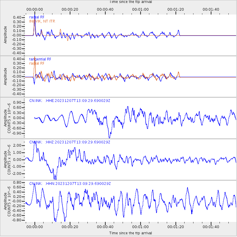
Signal To Noise
| Channel | StoN | STA | LTA |
| CN:INK: :HHZ:20231207T13:09:29.690029Z | 4.863662 | 1.4726579E-6 | 3.027879E-7 |
| CN:INK: :HHN:20231207T13:09:29.690029Z | 1.7456876 | 4.0736586E-7 | 2.3335552E-7 |
| CN:INK: :HHE:20231207T13:09:29.690029Z | 2.1936214 | 4.2069667E-7 | 1.9178181E-7 |
| Arrivals |
| Ps | |
| PpPs | |
| PsPs/PpSs | |


