You are here: Home > Network List > IW - Intermountain West Stations List
> Station MOOW Moose Ponds, Wyoming, USA > Earthquake Result Viewer
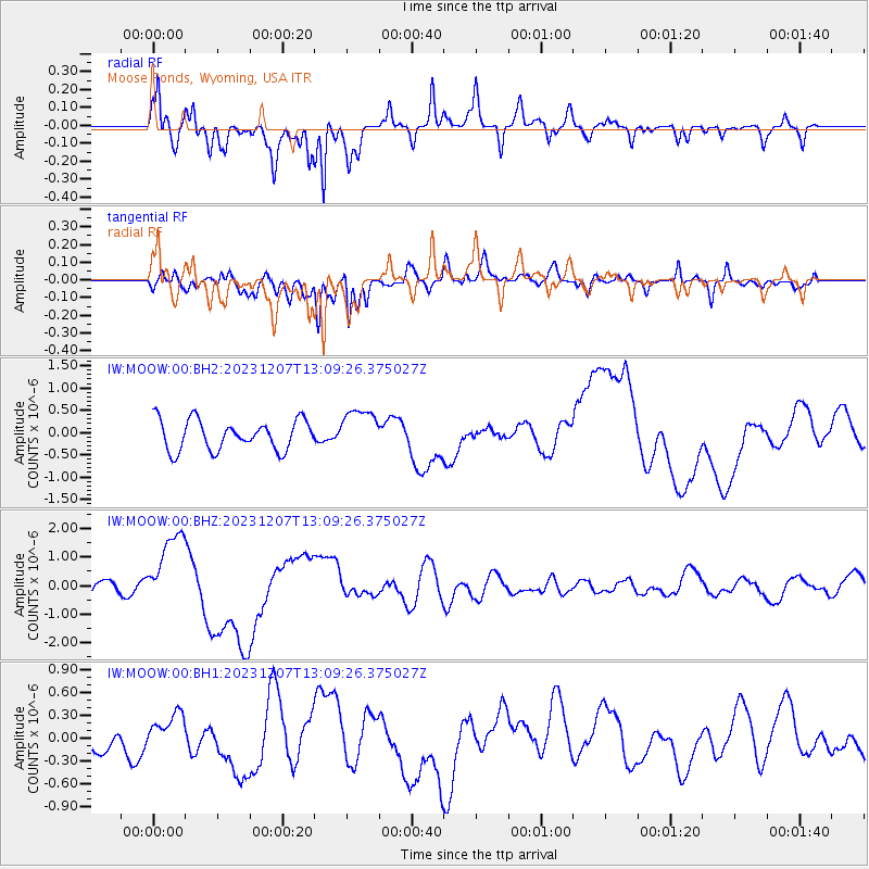
MOOW Moose Ponds, Wyoming, USA - Earthquake Result Viewer
*The percent match for this event was below the threshold and hence no stack was calculated.
| Earthquake location: |
Vanuatu Islands |
| Earthquake latitude/longitude: |
-20.7/169.2 |
| Earthquake time(UTC): |
2023/12/07 (341) 12:56:30 GMT |
| Earthquake Depth: |
48 km |
| Earthquake Magnitude: |
7.1 Mww |
| Earthquake Catalog/Contributor: |
NEIC PDE/us |
|
| Network: |
IW Intermountain West |
| Station: |
MOOW Moose Ponds, Wyoming, USA |
| Lat/Lon: |
43.75 N/110.74 W |
| Elevation: |
2128 m |
|
| Distance: |
97.1 deg |
| Az: |
46.003 deg |
| Baz: |
248.374 deg |
| Ray Param: |
$rayparam |
*The percent match for this event was below the threshold and hence was not used in the summary stack. |
|
| Radial Match: |
83.777916 % |
| Radial Bump: |
400 |
| Transverse Match: |
77.69579 % |
| Transverse Bump: |
400 |
| SOD ConfigId: |
33232451 |
| Insert Time: |
2023-12-21 15:58:03.407 +0000 |
| GWidth: |
2.5 |
| Max Bumps: |
400 |
| Tol: |
0.001 |
|
Signal To Noise
| Channel | StoN | STA | LTA |
| IW:MOOW:00:BHZ:20231207T13:09:26.375027Z | 4.1484985 | 1.3579959E-6 | 3.2734636E-7 |
| IW:MOOW:00:BH1:20231207T13:09:26.375027Z | 0.9250812 | 1.8829294E-7 | 2.0354207E-7 |
| IW:MOOW:00:BH2:20231207T13:09:26.375027Z | 1.4118843 | 4.750477E-7 | 3.3646361E-7 |
| Arrivals |
| Ps | |
| PpPs | |
| PsPs/PpSs | |


