You are here: Home > Network List > AK - Alaska Regional Network Stations List
> Station MDM Murphy Dome > Earthquake Result Viewer
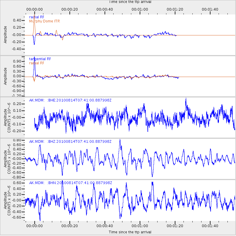
MDM Murphy Dome - Earthquake Result Viewer
*The percent match for this event was below the threshold and hence no stack was calculated.
| Earthquake location: |
South Of Mariana Islands |
| Earthquake latitude/longitude: |
12.3/141.5 |
| Earthquake time(UTC): |
2010/08/14 (226) 07:30:16 GMT |
| Earthquake Depth: |
10 km |
| Earthquake Magnitude: |
6.0 MB, 6.0 MS, 6.2 MW, 6.1 MW |
| Earthquake Catalog/Contributor: |
WHDF/NEIC |
|
| Network: |
AK Alaska Regional Network |
| Station: |
MDM Murphy Dome |
| Lat/Lon: |
64.96 N/148.23 W |
| Elevation: |
634 m |
|
| Distance: |
70.6 deg |
| Az: |
25.141 deg |
| Baz: |
257.266 deg |
| Ray Param: |
$rayparam |
*The percent match for this event was below the threshold and hence was not used in the summary stack. |
|
| Radial Match: |
55.691536 % |
| Radial Bump: |
400 |
| Transverse Match: |
81.59294 % |
| Transverse Bump: |
303 |
| SOD ConfigId: |
319893 |
| Insert Time: |
2011-01-05 21:38:52.321 +0000 |
| GWidth: |
2.5 |
| Max Bumps: |
400 |
| Tol: |
0.001 |
|
Signal To Noise
| Channel | StoN | STA | LTA |
| AK:MDM: :BHZ:20100814T07:41:00.887998Z | 5.540261 | 2.7372738E-7 | 4.940695E-8 |
| AK:MDM: :BHN:20100814T07:41:00.887998Z | 2.3783805 | 2.854196E-7 | 1.2000585E-7 |
| AK:MDM: :BHE:20100814T07:41:00.887998Z | 1.5459763 | 1.1613814E-7 | 7.512285E-8 |
| Arrivals |
| Ps | |
| PpPs | |
| PsPs/PpSs | |


