You are here: Home > Network List > AZ - ANZA Regional Network Stations List
> Station SMER AZ.SMER > Earthquake Result Viewer
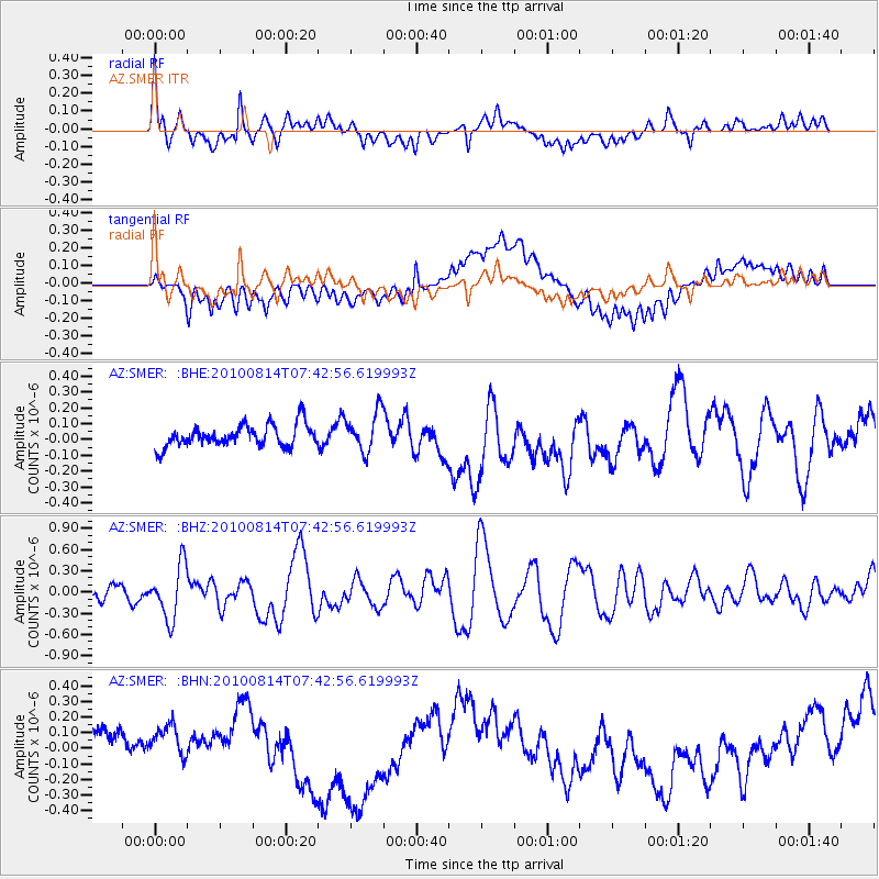
SMER AZ.SMER - Earthquake Result Viewer
*The percent match for this event was below the threshold and hence no stack was calculated.
| Earthquake location: |
South Of Mariana Islands |
| Earthquake latitude/longitude: |
12.3/141.5 |
| Earthquake time(UTC): |
2010/08/14 (226) 07:30:16 GMT |
| Earthquake Depth: |
10 km |
| Earthquake Magnitude: |
6.0 MB, 6.0 MS, 6.2 MW, 6.1 MW |
| Earthquake Catalog/Contributor: |
WHDF/NEIC |
|
| Network: |
AZ ANZA Regional Network |
| Station: |
SMER AZ.SMER |
| Lat/Lon: |
33.46 N/117.17 W |
| Elevation: |
355 m |
|
| Distance: |
92.5 deg |
| Az: |
55.131 deg |
| Baz: |
286.461 deg |
| Ray Param: |
$rayparam |
*The percent match for this event was below the threshold and hence was not used in the summary stack. |
|
| Radial Match: |
73.26058 % |
| Radial Bump: |
400 |
| Transverse Match: |
65.44159 % |
| Transverse Bump: |
400 |
| SOD ConfigId: |
319893 |
| Insert Time: |
2011-01-05 21:42:27.830 +0000 |
| GWidth: |
2.5 |
| Max Bumps: |
400 |
| Tol: |
0.001 |
|
Signal To Noise
| Channel | StoN | STA | LTA |
| AZ:SMER: :BHZ:20100814T07:42:56.619993Z | 4.671702 | 3.82344E-7 | 8.184255E-8 |
| AZ:SMER: :BHN:20100814T07:42:56.619993Z | 0.8501152 | 1.06316214E-7 | 1.2506095E-7 |
| AZ:SMER: :BHE:20100814T07:42:56.619993Z | 1.8360866 | 1.257712E-7 | 6.8499595E-8 |
| Arrivals |
| Ps | |
| PpPs | |
| PsPs/PpSs | |


