You are here: Home > Network List > IW - Intermountain West Stations List
> Station FXWY Fox Creek, Wyoming, USA > Earthquake Result Viewer
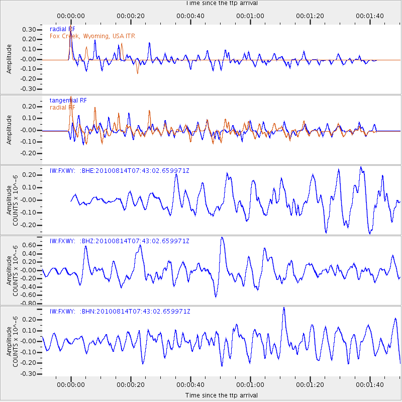
FXWY Fox Creek, Wyoming, USA - Earthquake Result Viewer

| Earthquake location: |
South Of Mariana Islands |
| Earthquake latitude/longitude: |
12.3/141.5 |
| Earthquake time(UTC): |
2010/08/14 (226) 07:30:16 GMT |
| Earthquake Depth: |
10 km |
| Earthquake Magnitude: |
6.0 MB, 6.0 MS, 6.2 MW, 6.1 MW |
| Earthquake Catalog/Contributor: |
WHDF/NEIC |
|
| Network: |
IW Intermountain West |
| Station: |
FXWY Fox Creek, Wyoming, USA |
| Lat/Lon: |
43.64 N/111.03 W |
| Elevation: |
2254 m |
|
| Distance: |
93.8 deg |
| Az: |
43.95 deg |
| Baz: |
290.915 deg |
| Ray Param: |
0.041180182 |
| Estimated Moho Depth: |
58.5 km |
| Estimated Crust Vp/Vs: |
1.86 |
| Assumed Crust Vp: |
6.207 km/s |
| Estimated Crust Vs: |
3.337 km/s |
| Estimated Crust Poisson's Ratio: |
0.30 |
|
| Radial Match: |
90.130264 % |
| Radial Bump: |
400 |
| Transverse Match: |
83.7522 % |
| Transverse Bump: |
400 |
| SOD ConfigId: |
319893 |
| Insert Time: |
2011-01-05 21:51:46.981 +0000 |
| GWidth: |
2.5 |
| Max Bumps: |
400 |
| Tol: |
0.001 |
|
Signal To Noise
| Channel | StoN | STA | LTA |
| IW:FXWY: :BHZ:20100814T07:43:02.659971Z | 4.1397185 | 2.1243521E-7 | 5.1316345E-8 |
| IW:FXWY: :BHN:20100814T07:43:02.659971Z | 0.7214 | 3.1328685E-8 | 4.342762E-8 |
| IW:FXWY: :BHE:20100814T07:43:02.659971Z | 2.3733366 | 6.8105194E-8 | 2.8695968E-8 |
| Arrivals |
| Ps | 8.3 SECOND |
| PpPs | 26 SECOND |
| PsPs/PpSs | 35 SECOND |


