You are here: Home > Network List > TA - USArray Transportable Network (new EarthScope stations) Stations List
> Station M04C Macdoel, CA, USA > Earthquake Result Viewer
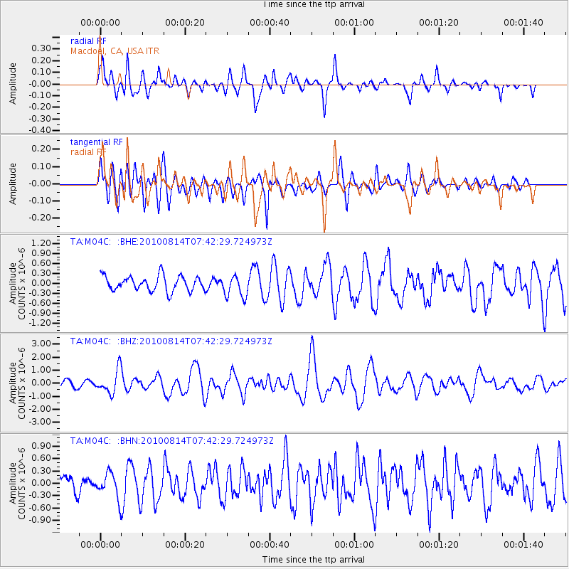
M04C Macdoel, CA, USA - Earthquake Result Viewer
*The percent match for this event was below the threshold and hence no stack was calculated.
| Earthquake location: |
South Of Mariana Islands |
| Earthquake latitude/longitude: |
12.3/141.5 |
| Earthquake time(UTC): |
2010/08/14 (226) 07:30:16 GMT |
| Earthquake Depth: |
10 km |
| Earthquake Magnitude: |
6.0 MB, 6.0 MS, 6.2 MW, 6.1 MW |
| Earthquake Catalog/Contributor: |
WHDF/NEIC |
|
| Network: |
TA USArray Transportable Network (new EarthScope stations) |
| Station: |
M04C Macdoel, CA, USA |
| Lat/Lon: |
41.78 N/121.84 W |
| Elevation: |
1391 m |
|
| Distance: |
86.8 deg |
| Az: |
48.073 deg |
| Baz: |
283.572 deg |
| Ray Param: |
$rayparam |
*The percent match for this event was below the threshold and hence was not used in the summary stack. |
|
| Radial Match: |
73.284134 % |
| Radial Bump: |
400 |
| Transverse Match: |
61.63283 % |
| Transverse Bump: |
400 |
| SOD ConfigId: |
319893 |
| Insert Time: |
2011-01-05 21:54:38.606 +0000 |
| GWidth: |
2.5 |
| Max Bumps: |
400 |
| Tol: |
0.001 |
|
Signal To Noise
| Channel | StoN | STA | LTA |
| TA:M04C: :BHZ:20100814T07:42:29.724973Z | 4.663736 | 9.2817714E-7 | 1.9902009E-7 |
| TA:M04C: :BHN:20100814T07:42:29.724973Z | 1.8570069 | 3.08852E-7 | 1.6631711E-7 |
| TA:M04C: :BHE:20100814T07:42:29.724973Z | 1.5088179 | 3.370471E-7 | 2.2338489E-7 |
| Arrivals |
| Ps | |
| PpPs | |
| PsPs/PpSs | |


