You are here: Home > Network List > TA - USArray Transportable Network (new EarthScope stations) Stations List
> Station K22A Casper, WY, USA > Earthquake Result Viewer
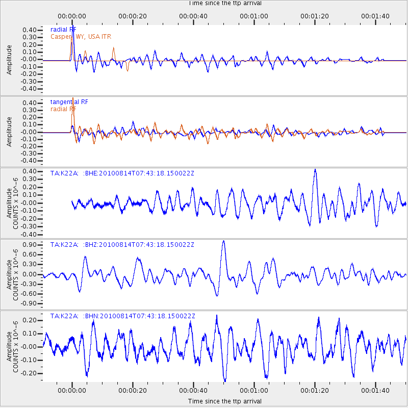
K22A Casper, WY, USA - Earthquake Result Viewer
*The percent match for this event was below the threshold and hence no stack was calculated.
| Earthquake location: |
South Of Mariana Islands |
| Earthquake latitude/longitude: |
12.3/141.5 |
| Earthquake time(UTC): |
2010/08/14 (226) 07:30:16 GMT |
| Earthquake Depth: |
10 km |
| Earthquake Magnitude: |
6.0 MB, 6.0 MS, 6.2 MW, 6.1 MW |
| Earthquake Catalog/Contributor: |
WHDF/NEIC |
|
| Network: |
TA USArray Transportable Network (new EarthScope stations) |
| Station: |
K22A Casper, WY, USA |
| Lat/Lon: |
42.65 N/106.52 W |
| Elevation: |
1686 m |
|
| Distance: |
97.3 deg |
| Az: |
43.601 deg |
| Baz: |
294.018 deg |
| Ray Param: |
$rayparam |
*The percent match for this event was below the threshold and hence was not used in the summary stack. |
|
| Radial Match: |
79.35121 % |
| Radial Bump: |
400 |
| Transverse Match: |
61.782402 % |
| Transverse Bump: |
400 |
| SOD ConfigId: |
319893 |
| Insert Time: |
2011-01-05 21:55:03.966 +0000 |
| GWidth: |
2.5 |
| Max Bumps: |
400 |
| Tol: |
0.001 |
|
Signal To Noise
| Channel | StoN | STA | LTA |
| TA:K22A: :BHZ:20100814T07:43:18.150022Z | 5.6219807 | 3.0373076E-7 | 5.402558E-8 |
| TA:K22A: :BHN:20100814T07:43:18.150022Z | 1.2027632 | 7.9246625E-8 | 6.5887136E-8 |
| TA:K22A: :BHE:20100814T07:43:18.150022Z | 2.125245 | 8.2446604E-8 | 3.8793925E-8 |
| Arrivals |
| Ps | |
| PpPs | |
| PsPs/PpSs | |


