You are here: Home > Network List > TA - USArray Transportable Network (new EarthScope stations) Stations List
> Station J21A Lysite, WY, USA > Earthquake Result Viewer
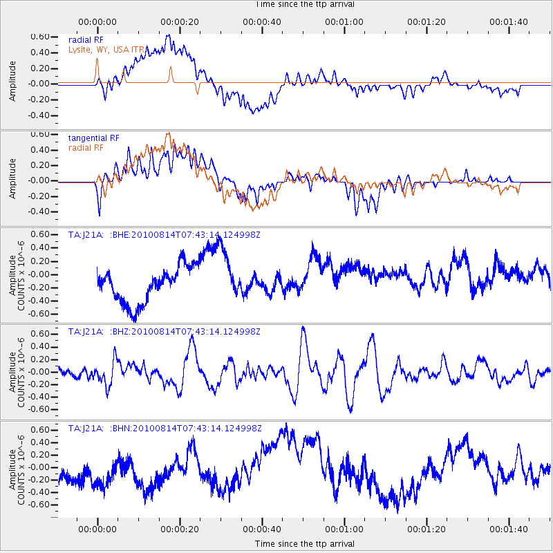
J21A Lysite, WY, USA - Earthquake Result Viewer
*The percent match for this event was below the threshold and hence no stack was calculated.
| Earthquake location: |
South Of Mariana Islands |
| Earthquake latitude/longitude: |
12.3/141.5 |
| Earthquake time(UTC): |
2010/08/14 (226) 07:30:16 GMT |
| Earthquake Depth: |
10 km |
| Earthquake Magnitude: |
6.0 MB, 6.0 MS, 6.2 MW, 6.1 MW |
| Earthquake Catalog/Contributor: |
WHDF/NEIC |
|
| Network: |
TA USArray Transportable Network (new EarthScope stations) |
| Station: |
J21A Lysite, WY, USA |
| Lat/Lon: |
43.35 N/107.45 W |
| Elevation: |
1913 m |
|
| Distance: |
96.4 deg |
| Az: |
43.234 deg |
| Baz: |
293.435 deg |
| Ray Param: |
$rayparam |
*The percent match for this event was below the threshold and hence was not used in the summary stack. |
|
| Radial Match: |
36.241062 % |
| Radial Bump: |
400 |
| Transverse Match: |
33.046608 % |
| Transverse Bump: |
400 |
| SOD ConfigId: |
319893 |
| Insert Time: |
2011-01-05 21:55:38.904 +0000 |
| GWidth: |
2.5 |
| Max Bumps: |
400 |
| Tol: |
0.001 |
|
Signal To Noise
| Channel | StoN | STA | LTA |
| TA:J21A: :BHZ:20100814T07:43:14.124998Z | 2.8541126 | 2.0264822E-7 | 7.1002184E-8 |
| TA:J21A: :BHN:20100814T07:43:14.124998Z | 1.3793178 | 4.0130556E-7 | 2.9094497E-7 |
| TA:J21A: :BHE:20100814T07:43:14.124998Z | 1.5649189 | 4.1177037E-7 | 2.6312568E-7 |
| Arrivals |
| Ps | |
| PpPs | |
| PsPs/PpSs | |


