You are here: Home > Network List > TA - USArray Transportable Network (new EarthScope stations) Stations List
> Station I24A Kuemmerle Ranch, Upton, WY, USA > Earthquake Result Viewer
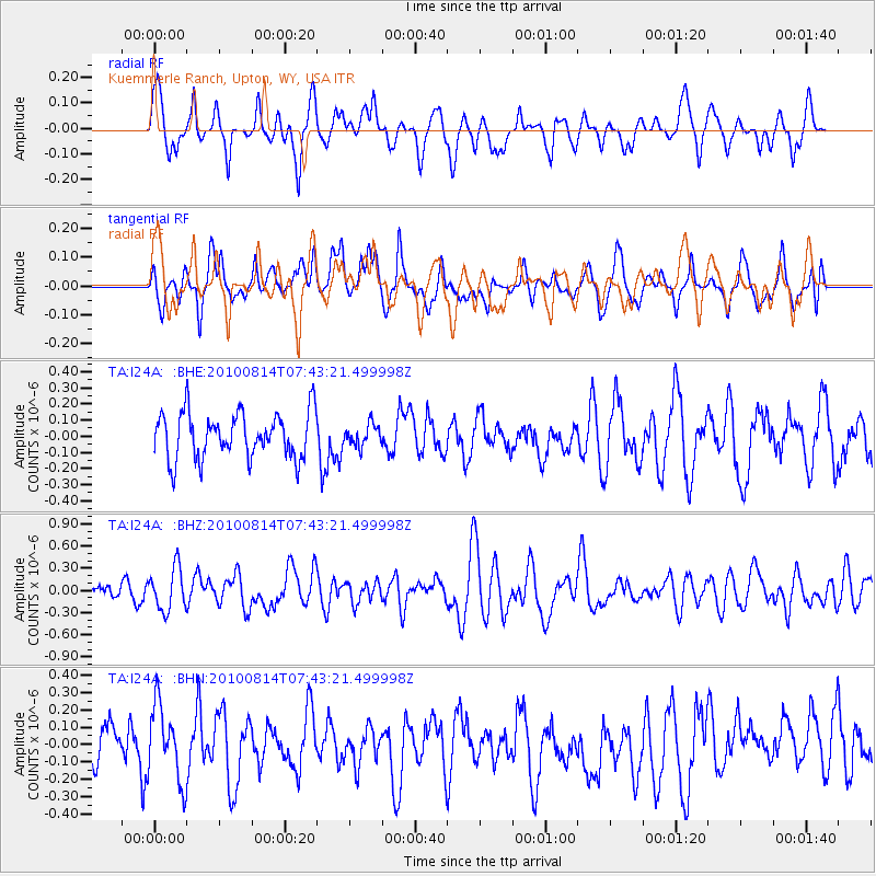
I24A Kuemmerle Ranch, Upton, WY, USA - Earthquake Result Viewer
*The percent match for this event was below the threshold and hence no stack was calculated.
| Earthquake location: |
South Of Mariana Islands |
| Earthquake latitude/longitude: |
12.3/141.5 |
| Earthquake time(UTC): |
2010/08/14 (226) 07:30:16 GMT |
| Earthquake Depth: |
10 km |
| Earthquake Magnitude: |
6.0 MB, 6.0 MS, 6.2 MW, 6.1 MW |
| Earthquake Catalog/Contributor: |
WHDF/NEIC |
|
| Network: |
TA USArray Transportable Network (new EarthScope stations) |
| Station: |
I24A Kuemmerle Ranch, Upton, WY, USA |
| Lat/Lon: |
43.86 N/104.63 W |
| Elevation: |
1338 m |
|
| Distance: |
98.0 deg |
| Az: |
41.908 deg |
| Baz: |
295.539 deg |
| Ray Param: |
$rayparam |
*The percent match for this event was below the threshold and hence was not used in the summary stack. |
|
| Radial Match: |
58.93201 % |
| Radial Bump: |
400 |
| Transverse Match: |
54.163723 % |
| Transverse Bump: |
400 |
| SOD ConfigId: |
319893 |
| Insert Time: |
2011-01-05 21:56:21.527 +0000 |
| GWidth: |
2.5 |
| Max Bumps: |
400 |
| Tol: |
0.001 |
|
Signal To Noise
| Channel | StoN | STA | LTA |
| TA:I24A: :BHZ:20100814T07:43:21.499998Z | 3.581275 | 2.851564E-7 | 7.962427E-8 |
| TA:I24A: :BHN:20100814T07:43:21.499998Z | 1.1781282 | 2.16141E-7 | 1.8346135E-7 |
| TA:I24A: :BHE:20100814T07:43:21.499998Z | 0.45772058 | 6.526508E-8 | 1.4258715E-7 |
| Arrivals |
| Ps | |
| PpPs | |
| PsPs/PpSs | |


