You are here: Home > Network List > US - United States National Seismic Network Stations List
> Station EGMT Eagleton, Montana, USA > Earthquake Result Viewer
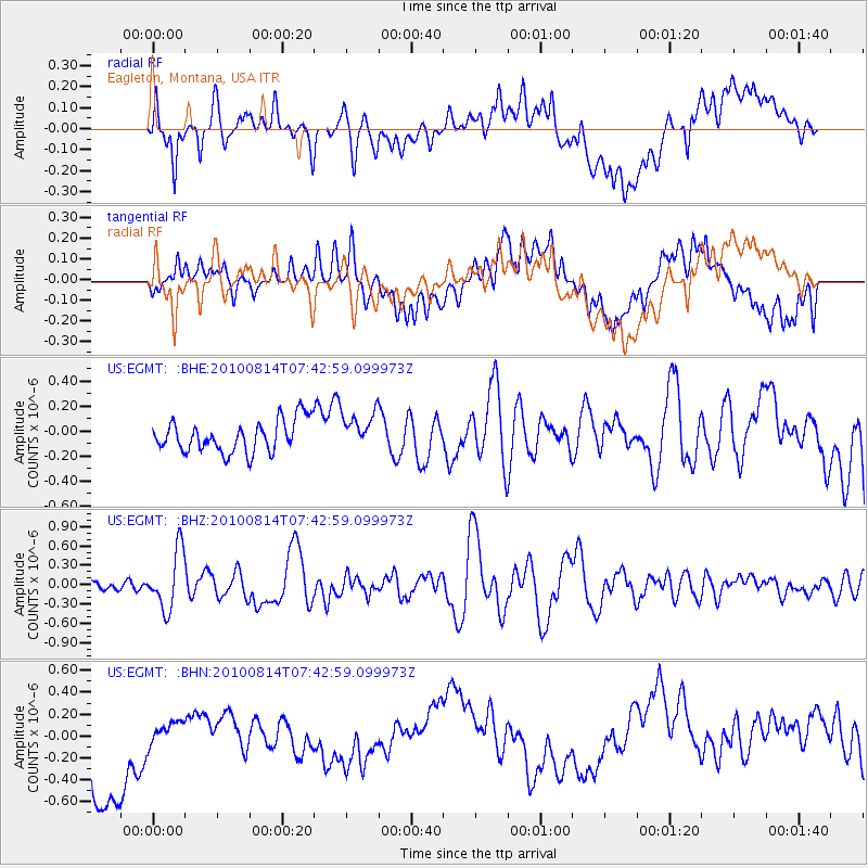
EGMT Eagleton, Montana, USA - Earthquake Result Viewer
*The percent match for this event was below the threshold and hence no stack was calculated.
| Earthquake location: |
South Of Mariana Islands |
| Earthquake latitude/longitude: |
12.3/141.5 |
| Earthquake time(UTC): |
2010/08/14 (226) 07:30:16 GMT |
| Earthquake Depth: |
10 km |
| Earthquake Magnitude: |
6.0 MB, 6.0 MS, 6.2 MW, 6.1 MW |
| Earthquake Catalog/Contributor: |
WHDF/NEIC |
|
| Network: |
US United States National Seismic Network |
| Station: |
EGMT Eagleton, Montana, USA |
| Lat/Lon: |
48.02 N/109.75 W |
| Elevation: |
1055 m |
|
| Distance: |
93.1 deg |
| Az: |
39.535 deg |
| Baz: |
292.091 deg |
| Ray Param: |
$rayparam |
*The percent match for this event was below the threshold and hence was not used in the summary stack. |
|
| Radial Match: |
45.438675 % |
| Radial Bump: |
400 |
| Transverse Match: |
24.658463 % |
| Transverse Bump: |
400 |
| SOD ConfigId: |
319893 |
| Insert Time: |
2011-01-05 22:02:02.760 +0000 |
| GWidth: |
2.5 |
| Max Bumps: |
400 |
| Tol: |
0.001 |
|
Signal To Noise
| Channel | StoN | STA | LTA |
| US:EGMT: :BHZ:20100814T07:42:59.099973Z | 8.117488 | 4.545954E-7 | 5.600198E-8 |
| US:EGMT: :BHN:20100814T07:42:59.099973Z | 0.3183181 | 1.7824175E-7 | 5.5994855E-7 |
| US:EGMT: :BHE:20100814T07:42:59.099973Z | 1.1659639 | 1.4865472E-7 | 1.2749513E-7 |
| Arrivals |
| Ps | |
| PpPs | |
| PsPs/PpSs | |


