You are here: Home > Network List > TA - USArray Transportable Network (new EarthScope stations) Stations List
> Station H25A Fruitdale, SD, USA > Earthquake Result Viewer
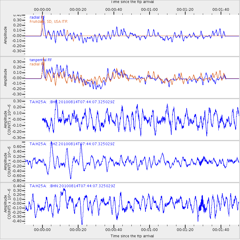
H25A Fruitdale, SD, USA - Earthquake Result Viewer
*The percent match for this event was below the threshold and hence no stack was calculated.
| Earthquake location: |
South Of Mariana Islands |
| Earthquake latitude/longitude: |
12.4/141.6 |
| Earthquake time(UTC): |
2010/08/14 (226) 07:31:01 GMT |
| Earthquake Depth: |
10 km |
| Earthquake Magnitude: |
5.7 MB |
| Earthquake Catalog/Contributor: |
WHDF/NEIC |
|
| Network: |
TA USArray Transportable Network (new EarthScope stations) |
| Station: |
H25A Fruitdale, SD, USA |
| Lat/Lon: |
44.62 N/103.60 W |
| Elevation: |
942 m |
|
| Distance: |
98.2 deg |
| Az: |
40.93 deg |
| Baz: |
296.331 deg |
| Ray Param: |
$rayparam |
*The percent match for this event was below the threshold and hence was not used in the summary stack. |
|
| Radial Match: |
71.16906 % |
| Radial Bump: |
400 |
| Transverse Match: |
59.082325 % |
| Transverse Bump: |
400 |
| SOD ConfigId: |
319893 |
| Insert Time: |
2011-01-05 22:25:55.078 +0000 |
| GWidth: |
2.5 |
| Max Bumps: |
400 |
| Tol: |
0.001 |
|
Signal To Noise
| Channel | StoN | STA | LTA |
| TA:H25A: :BHZ:20100814T07:44:07.325029Z | 1.2539424 | 2.712542E-7 | 2.1632113E-7 |
| TA:H25A: :BHN:20100814T07:44:07.325029Z | 1.0848727 | 1.4533612E-7 | 1.3396605E-7 |
| TA:H25A: :BHE:20100814T07:44:07.325029Z | 1.1502178 | 1.1046689E-7 | 9.6039976E-8 |
| Arrivals |
| Ps | |
| PpPs | |
| PsPs/PpSs | |


