You are here: Home > Network List > TA - USArray Transportable Network (new EarthScope stations) Stations List
> Station G05D Wamic, OR, USA > Earthquake Result Viewer
G05D Wamic, OR, USA - Earthquake Result Viewer
*The percent match for this event was below the threshold and hence no stack was calculated.
| Earthquake location: |
South Of Mariana Islands |
| Earthquake latitude/longitude: |
12.4/141.6 |
| Earthquake time(UTC): |
2010/08/14 (226) 07:31:01 GMT |
| Earthquake Depth: |
10 km |
| Earthquake Magnitude: |
5.7 MB |
| Earthquake Catalog/Contributor: |
WHDF/NEIC |
|
| Network: |
TA USArray Transportable Network (new EarthScope stations) |
| Station: |
G05D Wamic, OR, USA |
| Lat/Lon: |
45.24 N/121.32 W |
| Elevation: |
592 m |
|
| Distance: |
86.2 deg |
| Az: |
44.644 deg |
| Baz: |
283.666 deg |
| Ray Param: |
$rayparam |
*The percent match for this event was below the threshold and hence was not used in the summary stack. |
|
| Radial Match: |
72.62295 % |
| Radial Bump: |
400 |
| Transverse Match: |
63.771473 % |
| Transverse Bump: |
400 |
| SOD ConfigId: |
319893 |
| Insert Time: |
2011-01-05 22:26:43.847 +0000 |
| GWidth: |
2.5 |
| Max Bumps: |
400 |
| Tol: |
0.001 |
|
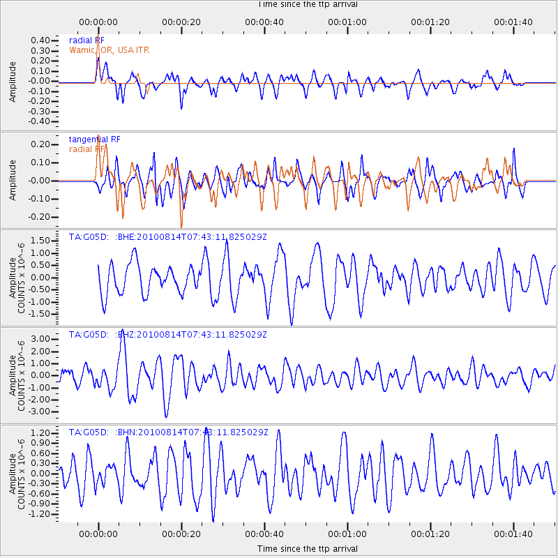
Signal To Noise
| Channel | StoN | STA | LTA |
| TA:G05D: :BHZ:20100814T07:43:11.825029Z | 1.0225888 | 8.2929915E-7 | 8.1098005E-7 |
| TA:G05D: :BHN:20100814T07:43:11.825029Z | 0.68435174 | 2.5656624E-7 | 3.7490406E-7 |
| TA:G05D: :BHE:20100814T07:43:11.825029Z | 1.4668366 | 8.401087E-7 | 5.727351E-7 |
| Arrivals |
| Ps | |
| PpPs | |
| PsPs/PpSs | |


