You are here: Home > Network List > CI - Caltech Regional Seismic Network Stations List
> Station MPP McPhearson Peak > Earthquake Result Viewer
MPP McPhearson Peak - Earthquake Result Viewer
*The percent match for this event was below the threshold and hence no stack was calculated.
| Earthquake location: |
Mariana Islands |
| Earthquake latitude/longitude: |
18.8/146.1 |
| Earthquake time(UTC): |
2023/12/10 (344) 14:11:39 GMT |
| Earthquake Depth: |
119 km |
| Earthquake Magnitude: |
5.7 mww |
| Earthquake Catalog/Contributor: |
NEIC PDE/us |
|
| Network: |
CI Caltech Regional Seismic Network |
| Station: |
MPP McPhearson Peak |
| Lat/Lon: |
34.89 N/119.81 W |
| Elevation: |
1739 m |
|
| Distance: |
82.7 deg |
| Az: |
55.751 deg |
| Baz: |
287.704 deg |
| Ray Param: |
$rayparam |
*The percent match for this event was below the threshold and hence was not used in the summary stack. |
|
| Radial Match: |
70.02104 % |
| Radial Bump: |
400 |
| Transverse Match: |
67.46961 % |
| Transverse Bump: |
384 |
| SOD ConfigId: |
33232451 |
| Insert Time: |
2023-12-24 14:22:27.376 +0000 |
| GWidth: |
2.5 |
| Max Bumps: |
400 |
| Tol: |
0.001 |
|
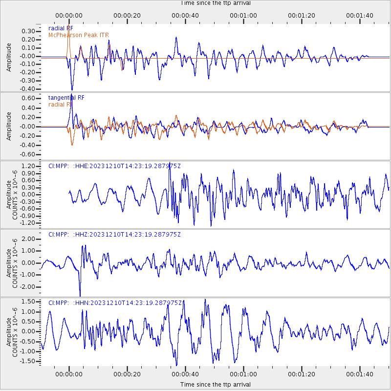
Signal To Noise
| Channel | StoN | STA | LTA |
| CI:MPP: :HHZ:20231210T14:23:19.287975Z | 3.392124 | 8.9106413E-7 | 2.6268617E-7 |
| CI:MPP: :HHN:20231210T14:23:19.287975Z | 0.7303604 | 3.3247792E-7 | 4.5522447E-7 |
| CI:MPP: :HHE:20231210T14:23:19.287975Z | 1.9450157 | 5.265078E-7 | 2.7069592E-7 |
| Arrivals |
| Ps | |
| PpPs | |
| PsPs/PpSs | |


