You are here: Home > Network List > US - United States National Seismic Network Stations List
> Station EGMT Eagleton, Montana, USA > Earthquake Result Viewer
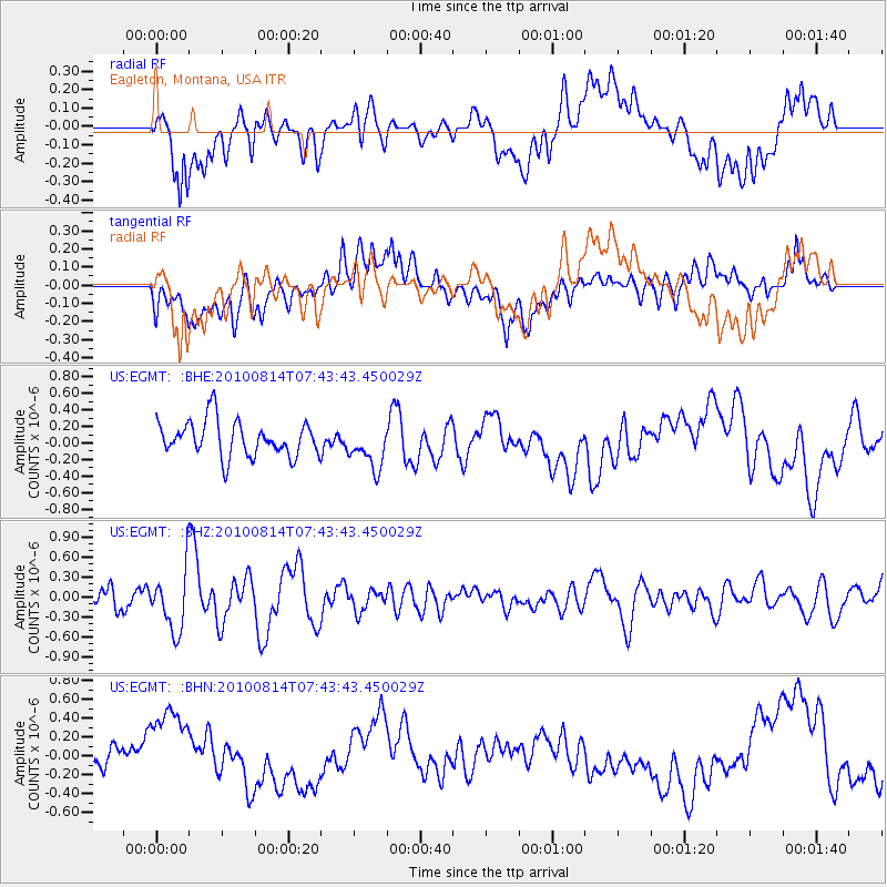
EGMT Eagleton, Montana, USA - Earthquake Result Viewer
*The percent match for this event was below the threshold and hence no stack was calculated.
| Earthquake location: |
South Of Mariana Islands |
| Earthquake latitude/longitude: |
12.4/141.6 |
| Earthquake time(UTC): |
2010/08/14 (226) 07:31:01 GMT |
| Earthquake Depth: |
10 km |
| Earthquake Magnitude: |
5.7 MB |
| Earthquake Catalog/Contributor: |
WHDF/NEIC |
|
| Network: |
US United States National Seismic Network |
| Station: |
EGMT Eagleton, Montana, USA |
| Lat/Lon: |
48.02 N/109.75 W |
| Elevation: |
1055 m |
|
| Distance: |
92.9 deg |
| Az: |
39.57 deg |
| Baz: |
292.021 deg |
| Ray Param: |
$rayparam |
*The percent match for this event was below the threshold and hence was not used in the summary stack. |
|
| Radial Match: |
41.58077 % |
| Radial Bump: |
400 |
| Transverse Match: |
28.0681 % |
| Transverse Bump: |
400 |
| SOD ConfigId: |
319893 |
| Insert Time: |
2011-01-05 22:28:07.981 +0000 |
| GWidth: |
2.5 |
| Max Bumps: |
400 |
| Tol: |
0.001 |
|
Signal To Noise
| Channel | StoN | STA | LTA |
| US:EGMT: :BHZ:20100814T07:43:43.450029Z | 1.601101 | 4.482369E-7 | 2.7995543E-7 |
| US:EGMT: :BHN:20100814T07:43:43.450029Z | 3.894271 | 5.860245E-7 | 1.5048376E-7 |
| US:EGMT: :BHE:20100814T07:43:43.450029Z | 1.2358416 | 2.6454632E-7 | 2.1406167E-7 |
| Arrivals |
| Ps | |
| PpPs | |
| PsPs/PpSs | |


