You are here: Home > Network List > CI - Caltech Regional Seismic Network Stations List
> Station BAR Barrett, Tecate, CA, USA > Earthquake Result Viewer
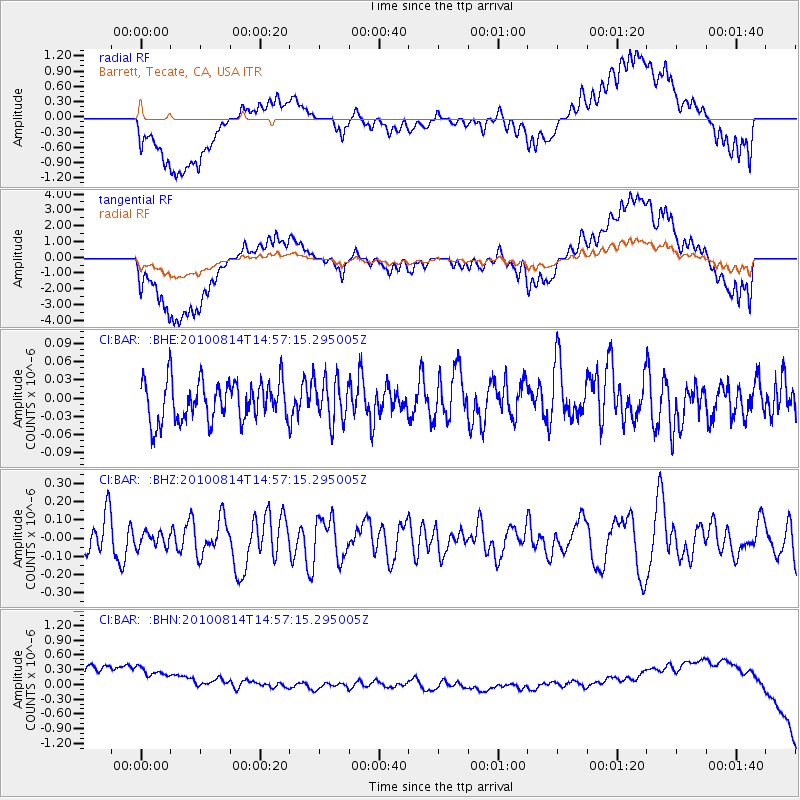
BAR Barrett, Tecate, CA, USA - Earthquake Result Viewer
*The percent match for this event was below the threshold and hence no stack was calculated.
| Earthquake location: |
South Of Mariana Islands |
| Earthquake latitude/longitude: |
12.3/141.5 |
| Earthquake time(UTC): |
2010/08/14 (226) 14:44:32 GMT |
| Earthquake Depth: |
10 km |
| Earthquake Magnitude: |
5.6 MB, 5.6 MW, 5.6 ME |
| Earthquake Catalog/Contributor: |
WHDF/NEIC |
|
| Network: |
CI Caltech Regional Seismic Network |
| Station: |
BAR Barrett, Tecate, CA, USA |
| Lat/Lon: |
32.68 N/116.67 W |
| Elevation: |
521 m |
|
| Distance: |
93.2 deg |
| Az: |
55.751 deg |
| Baz: |
286.682 deg |
| Ray Param: |
$rayparam |
*The percent match for this event was below the threshold and hence was not used in the summary stack. |
|
| Radial Match: |
34.668613 % |
| Radial Bump: |
400 |
| Transverse Match: |
34.471775 % |
| Transverse Bump: |
400 |
| SOD ConfigId: |
319893 |
| Insert Time: |
2011-01-05 22:31:57.545 +0000 |
| GWidth: |
2.5 |
| Max Bumps: |
400 |
| Tol: |
0.001 |
|
Signal To Noise
| Channel | StoN | STA | LTA |
| CI:BAR: :BHZ:20100814T14:57:15.295005Z | 0.4465 | 3.989851E-8 | 8.9358366E-8 |
| CI:BAR: :BHN:20100814T14:57:15.295005Z | 0.92076594 | 1.3619563E-6 | 1.4791558E-6 |
| CI:BAR: :BHE:20100814T14:57:15.295005Z | 1.0891329 | 3.5963232E-8 | 3.3020058E-8 |
| Arrivals |
| Ps | |
| PpPs | |
| PsPs/PpSs | |


