You are here: Home > Network List > II - Global Seismograph Network (GSN - IRIS/IDA) Stations List
> Station WRAB Tennant Creek, NT, Australia > Earthquake Result Viewer
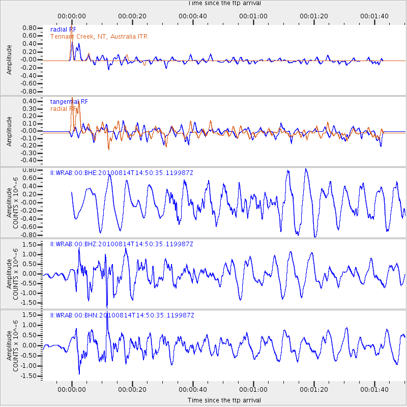
WRAB Tennant Creek, NT, Australia - Earthquake Result Viewer
*The percent match for this event was below the threshold and hence no stack was calculated.
| Earthquake location: |
South Of Mariana Islands |
| Earthquake latitude/longitude: |
12.3/141.5 |
| Earthquake time(UTC): |
2010/08/14 (226) 14:44:32 GMT |
| Earthquake Depth: |
10 km |
| Earthquake Magnitude: |
5.6 MB, 5.6 MW, 5.6 ME |
| Earthquake Catalog/Contributor: |
WHDF/NEIC |
|
| Network: |
II Global Seismograph Network (GSN - IRIS/IDA) |
| Station: |
WRAB Tennant Creek, NT, Australia |
| Lat/Lon: |
19.93 S/134.36 E |
| Elevation: |
366 m |
|
| Distance: |
32.8 deg |
| Az: |
192.401 deg |
| Baz: |
12.89 deg |
| Ray Param: |
$rayparam |
*The percent match for this event was below the threshold and hence was not used in the summary stack. |
|
| Radial Match: |
71.70768 % |
| Radial Bump: |
400 |
| Transverse Match: |
47.83945 % |
| Transverse Bump: |
397 |
| SOD ConfigId: |
319893 |
| Insert Time: |
2011-01-05 22:33:16.969 +0000 |
| GWidth: |
2.5 |
| Max Bumps: |
400 |
| Tol: |
0.001 |
|
Signal To Noise
| Channel | StoN | STA | LTA |
| II:WRAB:00:BHZ:20100814T14:50:35.119987Z | 1.3498269 | 4.6393336E-7 | 3.4369842E-7 |
| II:WRAB:00:BHN:20100814T14:50:35.119987Z | 1.9899579 | 5.7085856E-7 | 2.8686966E-7 |
| II:WRAB:00:BHE:20100814T14:50:35.119987Z | 0.6450282 | 2.2525347E-7 | 3.4921493E-7 |
| Arrivals |
| Ps | |
| PpPs | |
| PsPs/PpSs | |


