You are here: Home > Network List > IW - Intermountain West Stations List
> Station PLID Pearl Lake, Idaho, USA > Earthquake Result Viewer
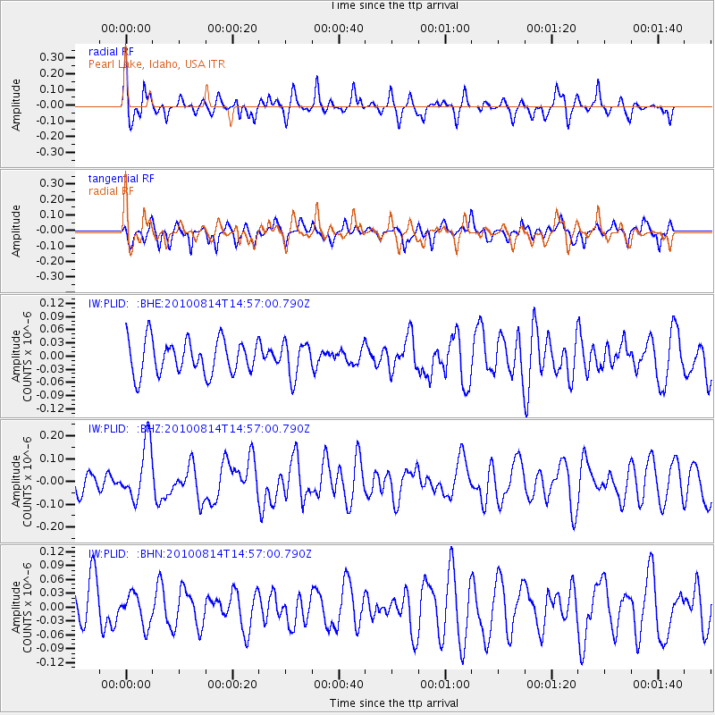
PLID Pearl Lake, Idaho, USA - Earthquake Result Viewer
*The percent match for this event was below the threshold and hence no stack was calculated.
| Earthquake location: |
South Of Mariana Islands |
| Earthquake latitude/longitude: |
12.3/141.5 |
| Earthquake time(UTC): |
2010/08/14 (226) 14:44:32 GMT |
| Earthquake Depth: |
10 km |
| Earthquake Magnitude: |
5.6 MB, 5.6 MW, 5.6 ME |
| Earthquake Catalog/Contributor: |
WHDF/NEIC |
|
| Network: |
IW Intermountain West |
| Station: |
PLID Pearl Lake, Idaho, USA |
| Lat/Lon: |
45.09 N/116.00 W |
| Elevation: |
2164 m |
|
| Distance: |
90.0 deg |
| Az: |
43.749 deg |
| Baz: |
287.445 deg |
| Ray Param: |
$rayparam |
*The percent match for this event was below the threshold and hence was not used in the summary stack. |
|
| Radial Match: |
62.771767 % |
| Radial Bump: |
400 |
| Transverse Match: |
54.624763 % |
| Transverse Bump: |
400 |
| SOD ConfigId: |
319893 |
| Insert Time: |
2011-01-05 22:34:00.576 +0000 |
| GWidth: |
2.5 |
| Max Bumps: |
400 |
| Tol: |
0.001 |
|
Signal To Noise
| Channel | StoN | STA | LTA |
| IW:PLID: :BHZ:20100814T14:57:00.790Z | 2.8008566 | 1.24851E-7 | 4.4576005E-8 |
| IW:PLID: :BHN:20100814T14:57:00.790Z | 0.8626702 | 3.420374E-8 | 3.964869E-8 |
| IW:PLID: :BHE:20100814T14:57:00.790Z | 1.0211773 | 3.9635772E-8 | 3.88138E-8 |
| Arrivals |
| Ps | |
| PpPs | |
| PsPs/PpSs | |


