You are here: Home > Network List > US - United States National Seismic Network Stations List
> Station EGMT Eagleton, Montana, USA > Earthquake Result Viewer
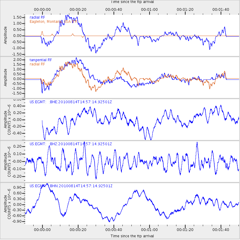
EGMT Eagleton, Montana, USA - Earthquake Result Viewer
*The percent match for this event was below the threshold and hence no stack was calculated.
| Earthquake location: |
South Of Mariana Islands |
| Earthquake latitude/longitude: |
12.3/141.5 |
| Earthquake time(UTC): |
2010/08/14 (226) 14:44:32 GMT |
| Earthquake Depth: |
10 km |
| Earthquake Magnitude: |
5.6 MB, 5.6 MW, 5.6 ME |
| Earthquake Catalog/Contributor: |
WHDF/NEIC |
|
| Network: |
US United States National Seismic Network |
| Station: |
EGMT Eagleton, Montana, USA |
| Lat/Lon: |
48.02 N/109.75 W |
| Elevation: |
1055 m |
|
| Distance: |
93.1 deg |
| Az: |
39.53 deg |
| Baz: |
292.085 deg |
| Ray Param: |
$rayparam |
*The percent match for this event was below the threshold and hence was not used in the summary stack. |
|
| Radial Match: |
39.814316 % |
| Radial Bump: |
400 |
| Transverse Match: |
24.810377 % |
| Transverse Bump: |
400 |
| SOD ConfigId: |
319893 |
| Insert Time: |
2011-01-05 22:36:55.752 +0000 |
| GWidth: |
2.5 |
| Max Bumps: |
400 |
| Tol: |
0.001 |
|
Signal To Noise
| Channel | StoN | STA | LTA |
| US:EGMT: :BHZ:20100814T14:57:14.92501Z | 2.182839 | 1.1907988E-7 | 5.4552753E-8 |
| US:EGMT: :BHN:20100814T14:57:14.92501Z | 2.9259205 | 1.2257849E-6 | 4.1893992E-7 |
| US:EGMT: :BHE:20100814T14:57:14.92501Z | 0.8028291 | 1.8711552E-7 | 2.3307018E-7 |
| Arrivals |
| Ps | |
| PpPs | |
| PsPs/PpSs | |


