You are here: Home > Network List > CI - Caltech Regional Seismic Network Stations List
> Station MPP McPhearson Peak > Earthquake Result Viewer
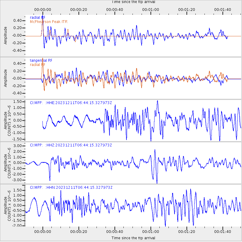
MPP McPhearson Peak - Earthquake Result Viewer
*The percent match for this event was below the threshold and hence no stack was calculated.
| Earthquake location: |
Tonga Islands |
| Earthquake latitude/longitude: |
-18.7/-175.5 |
| Earthquake time(UTC): |
2023/12/11 (345) 06:33:31 GMT |
| Earthquake Depth: |
238 km |
| Earthquake Magnitude: |
6.1 Mww |
| Earthquake Catalog/Contributor: |
NEIC PDE/us |
|
| Network: |
CI Caltech Regional Seismic Network |
| Station: |
MPP McPhearson Peak |
| Lat/Lon: |
34.89 N/119.81 W |
| Elevation: |
1739 m |
|
| Distance: |
75.0 deg |
| Az: |
44.644 deg |
| Baz: |
234.129 deg |
| Ray Param: |
$rayparam |
*The percent match for this event was below the threshold and hence was not used in the summary stack. |
|
| Radial Match: |
67.56959 % |
| Radial Bump: |
400 |
| Transverse Match: |
65.850876 % |
| Transverse Bump: |
400 |
| SOD ConfigId: |
33232451 |
| Insert Time: |
2023-12-25 06:50:33.912 +0000 |
| GWidth: |
2.5 |
| Max Bumps: |
400 |
| Tol: |
0.001 |
|
Signal To Noise
| Channel | StoN | STA | LTA |
| CI:MPP: :HHZ:20231211T06:44:15.327973Z | 3.5070314 | 8.623103E-7 | 2.4588041E-7 |
| CI:MPP: :HHN:20231211T06:44:15.327973Z | 0.86752045 | 5.3797794E-7 | 6.201329E-7 |
| CI:MPP: :HHE:20231211T06:44:15.327973Z | 1.0943035 | 3.3475536E-7 | 3.0590726E-7 |
| Arrivals |
| Ps | |
| PpPs | |
| PsPs/PpSs | |


