You are here: Home > Network List > CN - Canadian National Seismograph Network Stations List
> Station INK INUVIK, NT > Earthquake Result Viewer
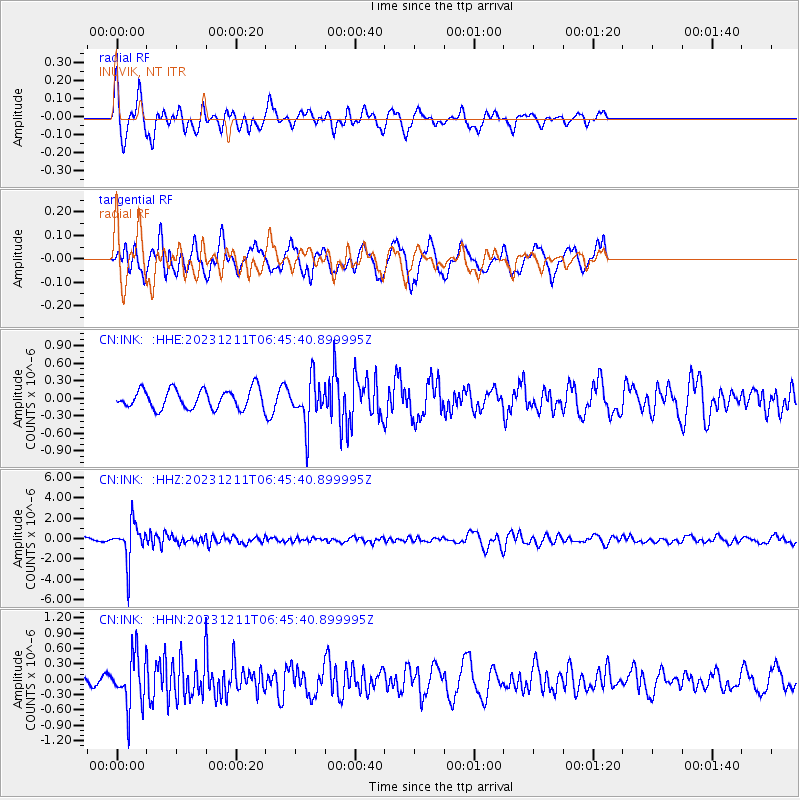
INK INUVIK, NT - Earthquake Result Viewer
*The percent match for this event was below the threshold and hence no stack was calculated.
| Earthquake location: |
Tonga Islands |
| Earthquake latitude/longitude: |
-18.7/-175.5 |
| Earthquake time(UTC): |
2023/12/11 (345) 06:33:31 GMT |
| Earthquake Depth: |
238 km |
| Earthquake Magnitude: |
6.1 Mww |
| Earthquake Catalog/Contributor: |
NEIC PDE/us |
|
| Network: |
CN Canadian National Seismograph Network |
| Station: |
INK INUVIK, NT |
| Lat/Lon: |
68.31 N/133.53 W |
| Elevation: |
44 m |
|
| Distance: |
91.9 deg |
| Az: |
14.401 deg |
| Baz: |
219.358 deg |
| Ray Param: |
$rayparam |
*The percent match for this event was below the threshold and hence was not used in the summary stack. |
|
| Radial Match: |
78.63766 % |
| Radial Bump: |
387 |
| Transverse Match: |
58.080627 % |
| Transverse Bump: |
394 |
| SOD ConfigId: |
33232451 |
| Insert Time: |
2023-12-25 06:51:59.091 +0000 |
| GWidth: |
2.5 |
| Max Bumps: |
400 |
| Tol: |
0.001 |
|
Signal To Noise
| Channel | StoN | STA | LTA |
| CN:INK: :HHZ:20231211T06:45:40.899995Z | 9.792934 | 1.899901E-6 | 1.9400733E-7 |
| CN:INK: :HHN:20231211T06:45:40.899995Z | 3.1928525 | 5.0215516E-7 | 1.5727477E-7 |
| CN:INK: :HHE:20231211T06:45:40.899995Z | 2.3480172 | 3.8459734E-7 | 1.6379664E-7 |
| Arrivals |
| Ps | |
| PpPs | |
| PsPs/PpSs | |


