You are here: Home > Network List > CI - Caltech Regional Seismic Network Stations List
> Station GSC Goldstone, Goldstone Lake, CA, USA > Earthquake Result Viewer
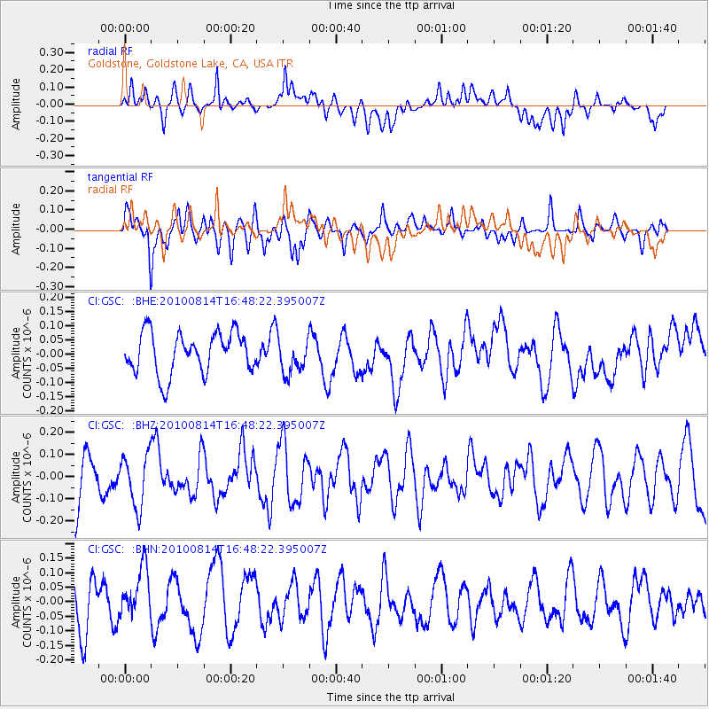
GSC Goldstone, Goldstone Lake, CA, USA - Earthquake Result Viewer
*The percent match for this event was below the threshold and hence no stack was calculated.
| Earthquake location: |
South Of Mariana Islands |
| Earthquake latitude/longitude: |
12.3/141.6 |
| Earthquake time(UTC): |
2010/08/14 (226) 16:35:43 GMT |
| Earthquake Depth: |
10 km |
| Earthquake Magnitude: |
5.7 MW, 5.4 MB |
| Earthquake Catalog/Contributor: |
WHDF/NEIC |
|
| Network: |
CI Caltech Regional Seismic Network |
| Station: |
GSC Goldstone, Goldstone Lake, CA, USA |
| Lat/Lon: |
35.30 N/116.81 W |
| Elevation: |
1000 m |
|
| Distance: |
92.3 deg |
| Az: |
53.3 deg |
| Baz: |
286.662 deg |
| Ray Param: |
$rayparam |
*The percent match for this event was below the threshold and hence was not used in the summary stack. |
|
| Radial Match: |
46.86362 % |
| Radial Bump: |
400 |
| Transverse Match: |
51.9015 % |
| Transverse Bump: |
400 |
| SOD ConfigId: |
319893 |
| Insert Time: |
2011-01-05 22:41:02.435 +0000 |
| GWidth: |
2.5 |
| Max Bumps: |
400 |
| Tol: |
0.001 |
|
Signal To Noise
| Channel | StoN | STA | LTA |
| CI:GSC: :BHZ:20100814T16:48:22.395007Z | 1.3814461 | 1.1924689E-7 | 8.6320334E-8 |
| CI:GSC: :BHN:20100814T16:48:22.395007Z | 1.3090224 | 9.385375E-8 | 7.1697585E-8 |
| CI:GSC: :BHE:20100814T16:48:22.395007Z | 0.8457862 | 6.050059E-8 | 7.153177E-8 |
| Arrivals |
| Ps | |
| PpPs | |
| PsPs/PpSs | |


