You are here: Home > Network List > GS - US Geological Survey Networks Stations List
> Station OK051 E0350 and S34600 roads, Ralston OK > Earthquake Result Viewer
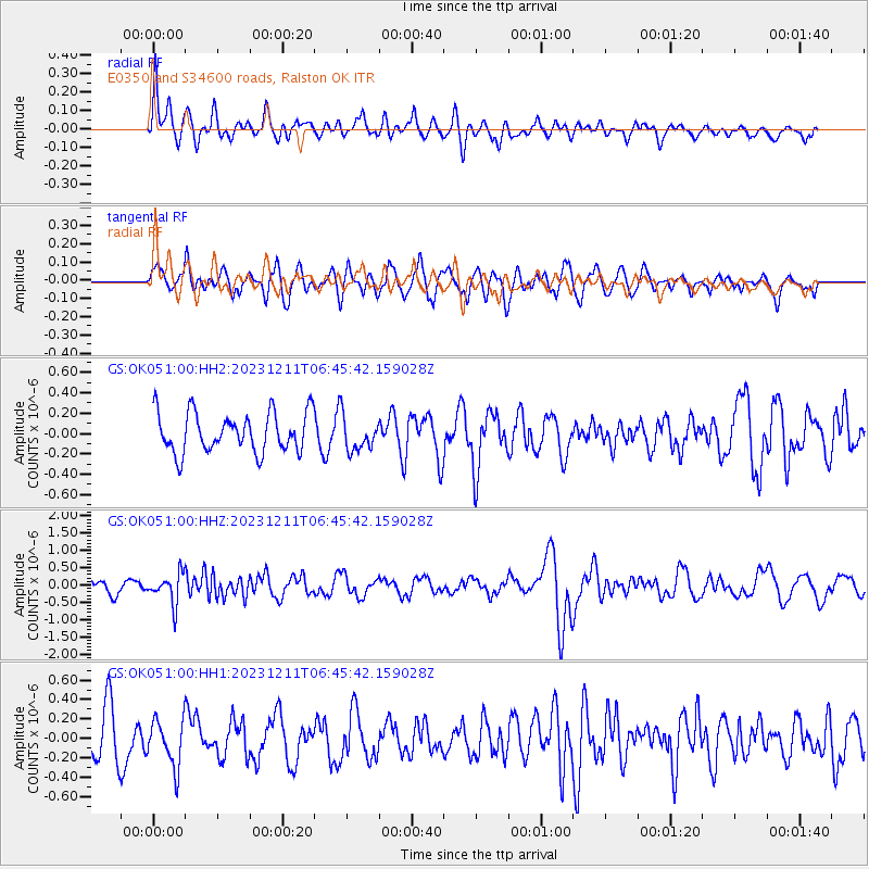
OK051 E0350 and S34600 roads, Ralston OK - Earthquake Result Viewer
*The percent match for this event was below the threshold and hence no stack was calculated.
| Earthquake location: |
Tonga Islands |
| Earthquake latitude/longitude: |
-18.7/-175.5 |
| Earthquake time(UTC): |
2023/12/11 (345) 06:33:31 GMT |
| Earthquake Depth: |
238 km |
| Earthquake Magnitude: |
6.1 Mww |
| Earthquake Catalog/Contributor: |
NEIC PDE/us |
|
| Network: |
GS US Geological Survey Networks |
| Station: |
OK051 E0350 and S34600 roads, Ralston OK |
| Lat/Lon: |
36.50 N/96.84 W |
| Elevation: |
263 m |
|
| Distance: |
92.2 deg |
| Az: |
52.234 deg |
| Baz: |
248.454 deg |
| Ray Param: |
$rayparam |
*The percent match for this event was below the threshold and hence was not used in the summary stack. |
|
| Radial Match: |
46.374207 % |
| Radial Bump: |
400 |
| Transverse Match: |
48.89761 % |
| Transverse Bump: |
400 |
| SOD ConfigId: |
33232451 |
| Insert Time: |
2023-12-25 06:53:56.797 +0000 |
| GWidth: |
2.5 |
| Max Bumps: |
400 |
| Tol: |
0.001 |
|
Signal To Noise
| Channel | StoN | STA | LTA |
| GS:OK051:00:HHZ:20231211T06:45:42.159028Z | 2.6409242 | 4.3146292E-7 | 1.6337573E-7 |
| GS:OK051:00:HH1:20231211T06:45:42.159028Z | 1.231634 | 2.4298754E-7 | 1.9728876E-7 |
| GS:OK051:00:HH2:20231211T06:45:42.159028Z | 0.8552587 | 1.6536389E-7 | 1.9334956E-7 |
| Arrivals |
| Ps | |
| PpPs | |
| PsPs/PpSs | |


