You are here: Home > Network List > CI - Caltech Regional Seismic Network Stations List
> Station SMM Simmler, CA, USA > Earthquake Result Viewer
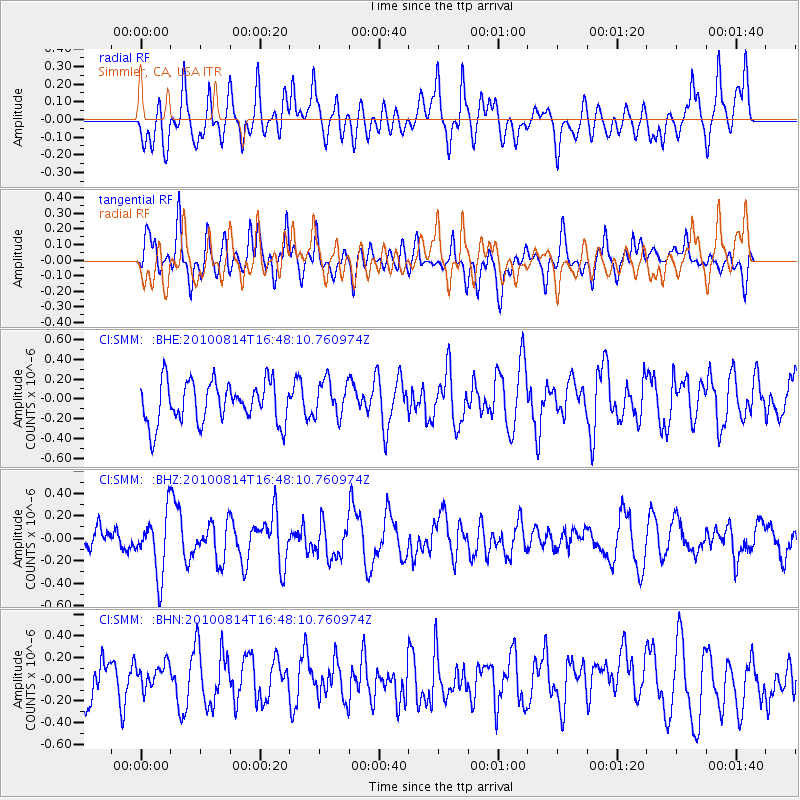
SMM Simmler, CA, USA - Earthquake Result Viewer
*The percent match for this event was below the threshold and hence no stack was calculated.
| Earthquake location: |
South Of Mariana Islands |
| Earthquake latitude/longitude: |
12.3/141.6 |
| Earthquake time(UTC): |
2010/08/14 (226) 16:35:43 GMT |
| Earthquake Depth: |
10 km |
| Earthquake Magnitude: |
5.7 MW, 5.4 MB |
| Earthquake Catalog/Contributor: |
WHDF/NEIC |
|
| Network: |
CI Caltech Regional Seismic Network |
| Station: |
SMM Simmler, CA, USA |
| Lat/Lon: |
35.31 N/120.00 W |
| Elevation: |
599 m |
|
| Distance: |
89.7 deg |
| Az: |
53.996 deg |
| Baz: |
284.814 deg |
| Ray Param: |
$rayparam |
*The percent match for this event was below the threshold and hence was not used in the summary stack. |
|
| Radial Match: |
48.45038 % |
| Radial Bump: |
400 |
| Transverse Match: |
57.55222 % |
| Transverse Bump: |
400 |
| SOD ConfigId: |
319893 |
| Insert Time: |
2011-01-05 22:41:48.024 +0000 |
| GWidth: |
2.5 |
| Max Bumps: |
400 |
| Tol: |
0.001 |
|
Signal To Noise
| Channel | StoN | STA | LTA |
| CI:SMM: :BHZ:20100814T16:48:10.760974Z | 3.752145 | 2.681871E-7 | 7.1475675E-8 |
| CI:SMM: :BHN:20100814T16:48:10.760974Z | 0.85167277 | 1.5435843E-7 | 1.8124148E-7 |
| CI:SMM: :BHE:20100814T16:48:10.760974Z | 0.8948946 | 1.8748028E-7 | 2.0949985E-7 |
| Arrivals |
| Ps | |
| PpPs | |
| PsPs/PpSs | |


