You are here: Home > Network List > IU - Global Seismograph Network (GSN - IRIS/USGS) Stations List
> Station CTAO Charters Towers, Australia > Earthquake Result Viewer
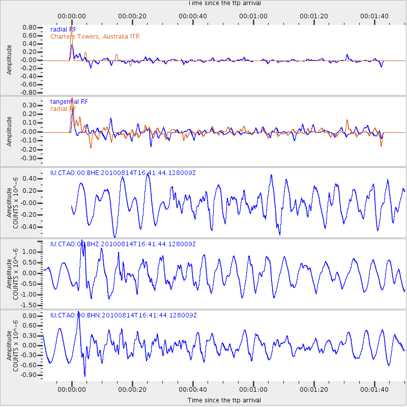
CTAO Charters Towers, Australia - Earthquake Result Viewer
*The percent match for this event was below the threshold and hence no stack was calculated.
| Earthquake location: |
South Of Mariana Islands |
| Earthquake latitude/longitude: |
12.3/141.6 |
| Earthquake time(UTC): |
2010/08/14 (226) 16:35:43 GMT |
| Earthquake Depth: |
10 km |
| Earthquake Magnitude: |
5.7 MW, 5.4 MB |
| Earthquake Catalog/Contributor: |
WHDF/NEIC |
|
| Network: |
IU Global Seismograph Network (GSN - IRIS/USGS) |
| Station: |
CTAO Charters Towers, Australia |
| Lat/Lon: |
20.09 S/146.25 E |
| Elevation: |
357 m |
|
| Distance: |
32.5 deg |
| Az: |
171.783 deg |
| Baz: |
351.453 deg |
| Ray Param: |
$rayparam |
*The percent match for this event was below the threshold and hence was not used in the summary stack. |
|
| Radial Match: |
59.613064 % |
| Radial Bump: |
378 |
| Transverse Match: |
59.440575 % |
| Transverse Bump: |
400 |
| SOD ConfigId: |
319893 |
| Insert Time: |
2011-01-05 22:43:34.409 +0000 |
| GWidth: |
2.5 |
| Max Bumps: |
400 |
| Tol: |
0.001 |
|
Signal To Noise
| Channel | StoN | STA | LTA |
| IU:CTAO:00:BHZ:20100814T16:41:44.128009Z | 3.332121 | 7.68942E-7 | 2.3076653E-7 |
| IU:CTAO:00:BHN:20100814T16:41:44.128009Z | 1.8756915 | 5.14092E-7 | 2.740813E-7 |
| IU:CTAO:00:BHE:20100814T16:41:44.128009Z | 0.51666695 | 1.276865E-7 | 2.4713503E-7 |
| Arrivals |
| Ps | |
| PpPs | |
| PsPs/PpSs | |


