You are here: Home > Network List > TA - USArray Transportable Network (new EarthScope stations) Stations List
> Station L02D Cave Junction, OR, USA > Earthquake Result Viewer
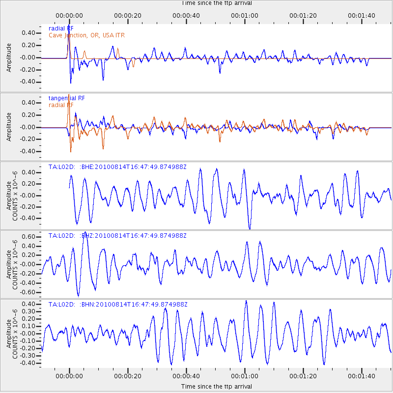
L02D Cave Junction, OR, USA - Earthquake Result Viewer
*The percent match for this event was below the threshold and hence no stack was calculated.
| Earthquake location: |
South Of Mariana Islands |
| Earthquake latitude/longitude: |
12.3/141.6 |
| Earthquake time(UTC): |
2010/08/14 (226) 16:35:43 GMT |
| Earthquake Depth: |
10 km |
| Earthquake Magnitude: |
5.7 MW, 5.4 MB |
| Earthquake Catalog/Contributor: |
WHDF/NEIC |
|
| Network: |
TA USArray Transportable Network (new EarthScope stations) |
| Station: |
L02D Cave Junction, OR, USA |
| Lat/Lon: |
42.16 N/123.60 W |
| Elevation: |
458 m |
|
| Distance: |
85.4 deg |
| Az: |
48.013 deg |
| Baz: |
282.307 deg |
| Ray Param: |
$rayparam |
*The percent match for this event was below the threshold and hence was not used in the summary stack. |
|
| Radial Match: |
48.99523 % |
| Radial Bump: |
400 |
| Transverse Match: |
44.135925 % |
| Transverse Bump: |
329 |
| SOD ConfigId: |
319893 |
| Insert Time: |
2011-01-05 22:46:48.287 +0000 |
| GWidth: |
2.5 |
| Max Bumps: |
400 |
| Tol: |
0.001 |
|
Signal To Noise
| Channel | StoN | STA | LTA |
| TA:L02D: :BHZ:20100814T16:47:49.874988Z | 1.6568688 | 3.5877045E-7 | 2.1653521E-7 |
| TA:L02D: :BHN:20100814T16:47:49.874988Z | 0.8690266 | 9.005673E-8 | 1.03629425E-7 |
| TA:L02D: :BHE:20100814T16:47:49.874988Z | 0.45123112 | 9.029567E-8 | 2.0010958E-7 |
| Arrivals |
| Ps | |
| PpPs | |
| PsPs/PpSs | |


