You are here: Home > Network List > US - United States National Seismic Network Stations List
> Station HAWA Hanford, Washington, USA > Earthquake Result Viewer
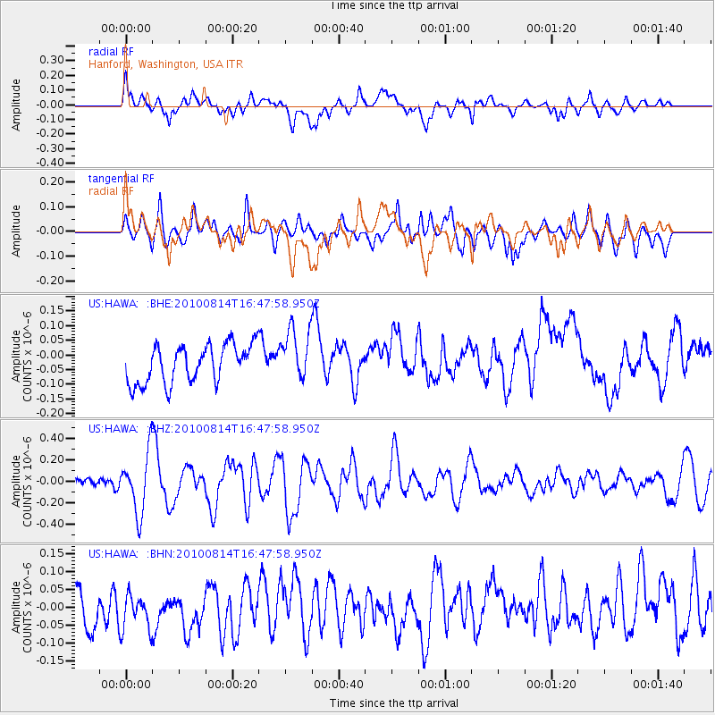
HAWA Hanford, Washington, USA - Earthquake Result Viewer
*The percent match for this event was below the threshold and hence no stack was calculated.
| Earthquake location: |
South Of Mariana Islands |
| Earthquake latitude/longitude: |
12.3/141.6 |
| Earthquake time(UTC): |
2010/08/14 (226) 16:35:43 GMT |
| Earthquake Depth: |
10 km |
| Earthquake Magnitude: |
5.7 MW, 5.4 MB |
| Earthquake Catalog/Contributor: |
WHDF/NEIC |
|
| Network: |
US United States National Seismic Network |
| Station: |
HAWA Hanford, Washington, USA |
| Lat/Lon: |
46.39 N/119.53 W |
| Elevation: |
364 m |
|
| Distance: |
87.2 deg |
| Az: |
43.204 deg |
| Baz: |
284.832 deg |
| Ray Param: |
$rayparam |
*The percent match for this event was below the threshold and hence was not used in the summary stack. |
|
| Radial Match: |
54.391438 % |
| Radial Bump: |
400 |
| Transverse Match: |
66.50187 % |
| Transverse Bump: |
400 |
| SOD ConfigId: |
319893 |
| Insert Time: |
2011-01-05 22:47:45.963 +0000 |
| GWidth: |
2.5 |
| Max Bumps: |
400 |
| Tol: |
0.001 |
|
Signal To Noise
| Channel | StoN | STA | LTA |
| US:HAWA: :BHZ:20100814T16:47:58.950Z | 3.9870985 | 2.836433E-7 | 7.114028E-8 |
| US:HAWA: :BHN:20100814T16:47:58.950Z | 1.01561 | 5.6343314E-8 | 5.547731E-8 |
| US:HAWA: :BHE:20100814T16:47:58.950Z | 1.4029444 | 9.068681E-8 | 6.4640346E-8 |
| Arrivals |
| Ps | |
| PpPs | |
| PsPs/PpSs | |


