You are here: Home > Network List > UW - Pacific Northwest Regional Seismic Network Stations List
> Station MRBL Marblemount, WA, USA > Earthquake Result Viewer
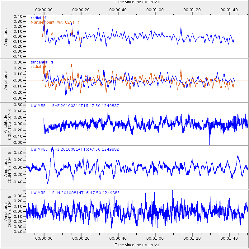
MRBL Marblemount, WA, USA - Earthquake Result Viewer
*The percent match for this event was below the threshold and hence no stack was calculated.
| Earthquake location: |
South Of Mariana Islands |
| Earthquake latitude/longitude: |
12.3/141.6 |
| Earthquake time(UTC): |
2010/08/14 (226) 16:35:43 GMT |
| Earthquake Depth: |
10 km |
| Earthquake Magnitude: |
5.7 MW, 5.4 MB |
| Earthquake Catalog/Contributor: |
WHDF/NEIC |
|
| Network: |
UW Pacific Northwest Regional Seismic Network |
| Station: |
MRBL Marblemount, WA, USA |
| Lat/Lon: |
48.52 N/121.48 W |
| Elevation: |
75 m |
|
| Distance: |
85.4 deg |
| Az: |
41.459 deg |
| Baz: |
283.287 deg |
| Ray Param: |
$rayparam |
*The percent match for this event was below the threshold and hence was not used in the summary stack. |
|
| Radial Match: |
50.53131 % |
| Radial Bump: |
400 |
| Transverse Match: |
60.258266 % |
| Transverse Bump: |
400 |
| SOD ConfigId: |
319893 |
| Insert Time: |
2011-01-05 22:48:47.780 +0000 |
| GWidth: |
2.5 |
| Max Bumps: |
400 |
| Tol: |
0.001 |
|
Signal To Noise
| Channel | StoN | STA | LTA |
| UW:MRBL: :BHZ:20100814T16:47:50.124988Z | 4.6393886 | 2.912081E-7 | 6.276864E-8 |
| UW:MRBL: :BHN:20100814T16:47:50.124988Z | 1.0711758 | 8.4592145E-8 | 7.8971304E-8 |
| UW:MRBL: :BHE:20100814T16:47:50.124988Z | 1.7102702 | 1.5174562E-7 | 8.872611E-8 |
| Arrivals |
| Ps | |
| PpPs | |
| PsPs/PpSs | |


