You are here: Home > Network List > US - United States National Seismic Network Stations List
> Station CBKS Cedar Bluff, Kansas, USA > Earthquake Result Viewer
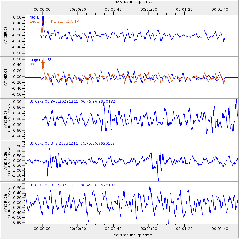
CBKS Cedar Bluff, Kansas, USA - Earthquake Result Viewer
*The percent match for this event was below the threshold and hence no stack was calculated.
| Earthquake location: |
Tonga Islands |
| Earthquake latitude/longitude: |
-18.7/-175.5 |
| Earthquake time(UTC): |
2023/12/11 (345) 06:33:31 GMT |
| Earthquake Depth: |
238 km |
| Earthquake Magnitude: |
6.1 Mww |
| Earthquake Catalog/Contributor: |
NEIC PDE/us |
|
| Network: |
US United States National Seismic Network |
| Station: |
CBKS Cedar Bluff, Kansas, USA |
| Lat/Lon: |
38.81 N/99.74 W |
| Elevation: |
677 m |
|
| Distance: |
90.9 deg |
| Az: |
49.225 deg |
| Baz: |
246.77 deg |
| Ray Param: |
$rayparam |
*The percent match for this event was below the threshold and hence was not used in the summary stack. |
|
| Radial Match: |
66.16482 % |
| Radial Bump: |
400 |
| Transverse Match: |
53.922836 % |
| Transverse Bump: |
400 |
| SOD ConfigId: |
33232451 |
| Insert Time: |
2023-12-25 07:08:33.677 +0000 |
| GWidth: |
2.5 |
| Max Bumps: |
400 |
| Tol: |
0.001 |
|
Signal To Noise
| Channel | StoN | STA | LTA |
| US:CBKS:00:BHZ:20231211T06:45:36.399018Z | 3.687661 | 6.2054596E-7 | 1.6827632E-7 |
| US:CBKS:00:BH1:20231211T06:45:36.399018Z | 1.330533 | 2.7424676E-7 | 2.0611796E-7 |
| US:CBKS:00:BH2:20231211T06:45:36.399018Z | 1.8236263 | 3.383538E-7 | 1.8553901E-7 |
| Arrivals |
| Ps | |
| PpPs | |
| PsPs/PpSs | |


