You are here: Home > Network List > CI - Caltech Regional Seismic Network Stations List
> Station SWS Sam W. Stewart, Westmorland, CA, USA > Earthquake Result Viewer
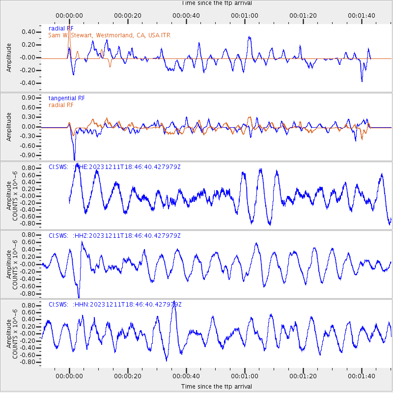
SWS Sam W. Stewart, Westmorland, CA, USA - Earthquake Result Viewer
*The percent match for this event was below the threshold and hence no stack was calculated.
| Earthquake location: |
Salta Province, Argentina |
| Earthquake latitude/longitude: |
-24.1/-66.8 |
| Earthquake time(UTC): |
2023/12/11 (345) 18:36:00 GMT |
| Earthquake Depth: |
195 km |
| Earthquake Magnitude: |
5.5 Mww |
| Earthquake Catalog/Contributor: |
NEIC PDE/us |
|
| Network: |
CI Caltech Regional Seismic Network |
| Station: |
SWS Sam W. Stewart, Westmorland, CA, USA |
| Lat/Lon: |
32.94 N/115.80 W |
| Elevation: |
140 m |
|
| Distance: |
73.5 deg |
| Az: |
318.578 deg |
| Baz: |
134.034 deg |
| Ray Param: |
$rayparam |
*The percent match for this event was below the threshold and hence was not used in the summary stack. |
|
| Radial Match: |
49.943794 % |
| Radial Bump: |
400 |
| Transverse Match: |
68.582825 % |
| Transverse Bump: |
400 |
| SOD ConfigId: |
33232451 |
| Insert Time: |
2023-12-25 18:42:01.046 +0000 |
| GWidth: |
2.5 |
| Max Bumps: |
400 |
| Tol: |
0.001 |
|
Signal To Noise
| Channel | StoN | STA | LTA |
| CI:SWS: :HHZ:20231211T18:46:40.427979Z | 2.5719583 | 4.5831072E-7 | 1.7819525E-7 |
| CI:SWS: :HHN:20231211T18:46:40.427979Z | 1.0649621 | 3.3137036E-7 | 3.1115692E-7 |
| CI:SWS: :HHE:20231211T18:46:40.427979Z | 0.6973188 | 2.5628344E-7 | 3.6752692E-7 |
| Arrivals |
| Ps | |
| PpPs | |
| PsPs/PpSs | |


