You are here: Home > Network List > G - GEOSCOPE Stations List
> Station INU Inuyama, Japan > Earthquake Result Viewer
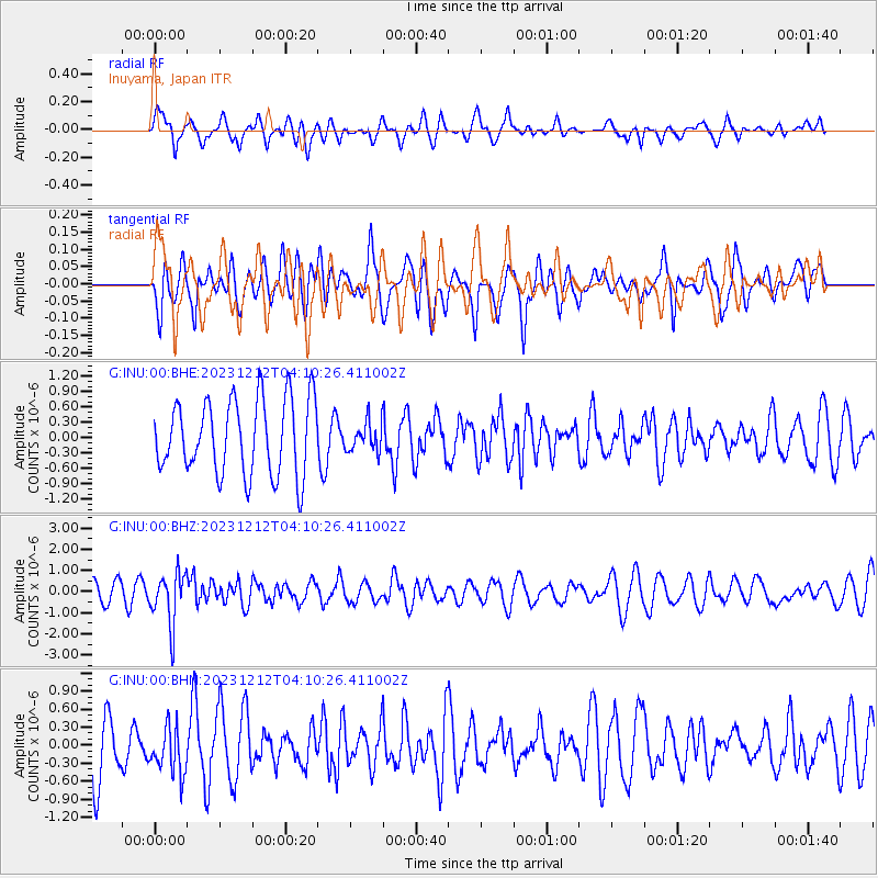
INU Inuyama, Japan - Earthquake Result Viewer
*The percent match for this event was below the threshold and hence no stack was calculated.
| Earthquake location: |
Tonga Islands |
| Earthquake latitude/longitude: |
-18.0/-175.3 |
| Earthquake time(UTC): |
2023/12/12 (346) 04:00:15 GMT |
| Earthquake Depth: |
261 km |
| Earthquake Magnitude: |
5.8 Mww |
| Earthquake Catalog/Contributor: |
NEIC PDE/us |
|
| Network: |
G GEOSCOPE |
| Station: |
INU Inuyama, Japan |
| Lat/Lon: |
35.35 N/137.03 E |
| Elevation: |
132 m |
|
| Distance: |
69.7 deg |
| Az: |
319.897 deg |
| Baz: |
131.428 deg |
| Ray Param: |
$rayparam |
*The percent match for this event was below the threshold and hence was not used in the summary stack. |
|
| Radial Match: |
31.590755 % |
| Radial Bump: |
377 |
| Transverse Match: |
50.46769 % |
| Transverse Bump: |
400 |
| SOD ConfigId: |
33232451 |
| Insert Time: |
2023-12-26 04:15:43.644 +0000 |
| GWidth: |
2.5 |
| Max Bumps: |
400 |
| Tol: |
0.001 |
|
Signal To Noise
| Channel | StoN | STA | LTA |
| G:INU:00:BHZ:20231212T04:10:26.411002Z | 3.6664858 | 1.2210496E-6 | 3.3302996E-7 |
| G:INU:00:BHN:20231212T04:10:26.411002Z | 0.8599776 | 3.8430943E-7 | 4.4688306E-7 |
| G:INU:00:BHE:20231212T04:10:26.411002Z | 0.38751867 | 2.8322648E-7 | 7.308719E-7 |
| Arrivals |
| Ps | |
| PpPs | |
| PsPs/PpSs | |


