You are here: Home > Network List > IW - Intermountain West Stations List
> Station PLID Pearl Lake, Idaho, USA > Earthquake Result Viewer
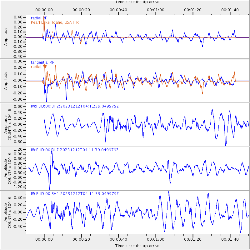
PLID Pearl Lake, Idaho, USA - Earthquake Result Viewer
*The percent match for this event was below the threshold and hence no stack was calculated.
| Earthquake location: |
Tonga Islands |
| Earthquake latitude/longitude: |
-18.0/-175.3 |
| Earthquake time(UTC): |
2023/12/12 (346) 04:00:15 GMT |
| Earthquake Depth: |
261 km |
| Earthquake Magnitude: |
5.8 Mww |
| Earthquake Catalog/Contributor: |
NEIC PDE/us |
|
| Network: |
IW Intermountain West |
| Station: |
PLID Pearl Lake, Idaho, USA |
| Lat/Lon: |
45.09 N/116.00 W |
| Elevation: |
2164 m |
|
| Distance: |
82.7 deg |
| Az: |
37.891 deg |
| Baz: |
235.58 deg |
| Ray Param: |
$rayparam |
*The percent match for this event was below the threshold and hence was not used in the summary stack. |
|
| Radial Match: |
64.20989 % |
| Radial Bump: |
400 |
| Transverse Match: |
57.191803 % |
| Transverse Bump: |
400 |
| SOD ConfigId: |
33232451 |
| Insert Time: |
2023-12-26 04:17:47.575 +0000 |
| GWidth: |
2.5 |
| Max Bumps: |
400 |
| Tol: |
0.001 |
|
Signal To Noise
| Channel | StoN | STA | LTA |
| IW:PLID:00:BHZ:20231212T04:11:39.049979Z | 3.382598 | 6.2080727E-7 | 1.8352972E-7 |
| IW:PLID:00:BH1:20231212T04:11:39.049979Z | 1.5461267 | 2.0144887E-7 | 1.3029259E-7 |
| IW:PLID:00:BH2:20231212T04:11:39.049979Z | 1.548129 | 2.6721338E-7 | 1.7260409E-7 |
| Arrivals |
| Ps | |
| PpPs | |
| PsPs/PpSs | |


