TKM2 KN.TKM2 - Earthquake Result Viewer
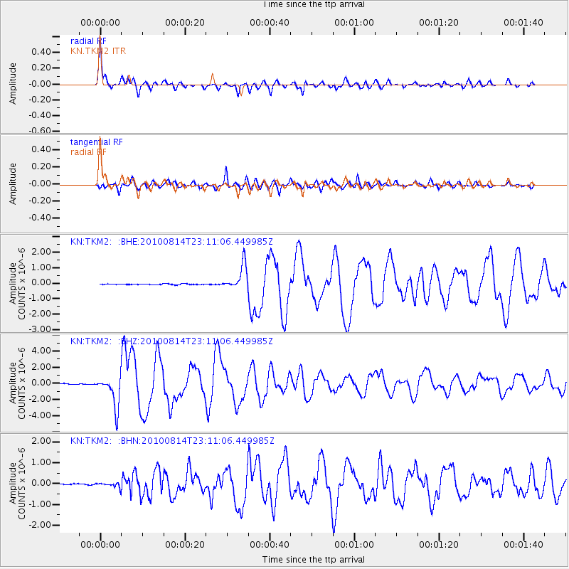
Earthquake location: South Of Mariana Islands
Earthquake latitude/longitude: 12.3/141.4
Earthquake time(UTC): 2010/08/14 (226) 23:01:04 GMT
Earthquake Depth: 13 km
Earthquake Magnitude: 6.1 MB, 6.3 MS, 6.6 MW, 6.3 MW
Earthquake Catalog/Contributor: WHDF/NEIC
Network: KN Kyrgyz Seismic Telemetry Network
Station: TKM2 KN.TKM2
Lat/Lon: 42.92 N/75.60 E
Elevation: 2020 m
Distance: 64.1 deg
Az: 311.823 deg
Baz: 97.435 deg
Ray Param: 0.059155088
Estimated Moho Depth: 64.0 km
Estimated Crust Vp/Vs: 2.02
Assumed Crust Vp: 6.306 km/s
Estimated Crust Vs: 3.118 km/s
Estimated Crust Poisson's Ratio: 0.34
Radial Match: 97.90483 %
Radial Bump: 339
Transverse Match: 92.65062 %
Transverse Bump: 400
SOD ConfigId: 319893
Insert Time: 2011-01-05 23:03:41.032 +0000
GWidth: 2.5
Max Bumps: 400
Tol: 0.001

Signal To Noise

ChannelStoNSTALTA
KN:TKM2: :BHZ:20100814T23:11:06.449985Z35.928921.984192E-65.5225485E-8
KN:TKM2: :BHN:20100814T23:11:06.449985Z4.49120041.1232697E-72.5010456E-8
KN:TKM2: :BHE:20100814T23:11:06.449985Z29.4194228.284354E-72.8159473E-8
Arrivals
Ps11 SECOND
PpPs30 SECOND
PsPs/PpSs40 SECOND