You are here: Home > Network List > US - United States National Seismic Network Stations List
> Station MNTX Cornudas Mountains, Texas, USA > Earthquake Result Viewer
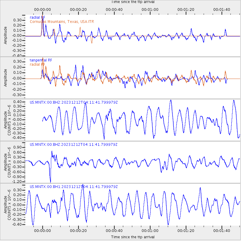
MNTX Cornudas Mountains, Texas, USA - Earthquake Result Viewer
*The percent match for this event was below the threshold and hence no stack was calculated.
| Earthquake location: |
Tonga Islands |
| Earthquake latitude/longitude: |
-18.0/-175.3 |
| Earthquake time(UTC): |
2023/12/12 (346) 04:00:15 GMT |
| Earthquake Depth: |
261 km |
| Earthquake Magnitude: |
5.8 Mww |
| Earthquake Catalog/Contributor: |
NEIC PDE/us |
|
| Network: |
US United States National Seismic Network |
| Station: |
MNTX Cornudas Mountains, Texas, USA |
| Lat/Lon: |
31.70 N/105.38 W |
| Elevation: |
405 m |
|
| Distance: |
83.3 deg |
| Az: |
53.728 deg |
| Baz: |
244.151 deg |
| Ray Param: |
$rayparam |
*The percent match for this event was below the threshold and hence was not used in the summary stack. |
|
| Radial Match: |
50.38864 % |
| Radial Bump: |
374 |
| Transverse Match: |
37.01303 % |
| Transverse Bump: |
315 |
| SOD ConfigId: |
33232451 |
| Insert Time: |
2023-12-26 04:28:17.312 +0000 |
| GWidth: |
2.5 |
| Max Bumps: |
400 |
| Tol: |
0.001 |
|
Signal To Noise
| Channel | StoN | STA | LTA |
| US:MNTX:00:BHZ:20231212T04:11:41.799979Z | 4.4264874 | 3.572765E-7 | 8.071331E-8 |
| US:MNTX:00:BH1:20231212T04:11:41.799979Z | 0.57019144 | 9.16117E-8 | 1.6066832E-7 |
| US:MNTX:00:BH2:20231212T04:11:41.799979Z | 0.90591764 | 1.6719832E-7 | 1.845624E-7 |
| Arrivals |
| Ps | |
| PpPs | |
| PsPs/PpSs | |


