You are here: Home > Network List > US - United States National Seismic Network Stations List
> Station WUAZ Wupatki, Arizona, USA > Earthquake Result Viewer
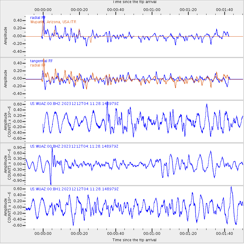
WUAZ Wupatki, Arizona, USA - Earthquake Result Viewer
*The percent match for this event was below the threshold and hence no stack was calculated.
| Earthquake location: |
Tonga Islands |
| Earthquake latitude/longitude: |
-18.0/-175.3 |
| Earthquake time(UTC): |
2023/12/12 (346) 04:00:15 GMT |
| Earthquake Depth: |
261 km |
| Earthquake Magnitude: |
5.8 Mww |
| Earthquake Catalog/Contributor: |
NEIC PDE/us |
|
| Network: |
US United States National Seismic Network |
| Station: |
WUAZ Wupatki, Arizona, USA |
| Lat/Lon: |
35.52 N/111.37 W |
| Elevation: |
1592 m |
|
| Distance: |
80.6 deg |
| Az: |
47.969 deg |
| Baz: |
240.037 deg |
| Ray Param: |
$rayparam |
*The percent match for this event was below the threshold and hence was not used in the summary stack. |
|
| Radial Match: |
60.70059 % |
| Radial Bump: |
400 |
| Transverse Match: |
42.692936 % |
| Transverse Bump: |
400 |
| SOD ConfigId: |
33232451 |
| Insert Time: |
2023-12-26 04:28:28.165 +0000 |
| GWidth: |
2.5 |
| Max Bumps: |
400 |
| Tol: |
0.001 |
|
Signal To Noise
| Channel | StoN | STA | LTA |
| US:WUAZ:00:BHZ:20231212T04:11:28.148979Z | 2.6348433 | 3.9786542E-7 | 1.5100156E-7 |
| US:WUAZ:00:BH1:20231212T04:11:28.148979Z | 0.8454072 | 1.8244084E-7 | 2.1580233E-7 |
| US:WUAZ:00:BH2:20231212T04:11:28.148979Z | 0.680157 | 1.3928599E-7 | 2.0478507E-7 |
| Arrivals |
| Ps | |
| PpPs | |
| PsPs/PpSs | |


