You are here: Home > Network List > UW - Pacific Northwest Regional Seismic Network Stations List
> Station UMAT Pilot Rock, OR, USA > Earthquake Result Viewer
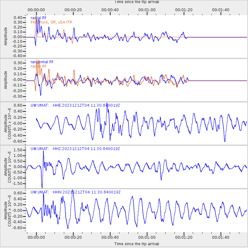
UMAT Pilot Rock, OR, USA - Earthquake Result Viewer
*The percent match for this event was below the threshold and hence no stack was calculated.
| Earthquake location: |
Tonga Islands |
| Earthquake latitude/longitude: |
-18.0/-175.3 |
| Earthquake time(UTC): |
2023/12/12 (346) 04:00:15 GMT |
| Earthquake Depth: |
261 km |
| Earthquake Magnitude: |
5.8 Mww |
| Earthquake Catalog/Contributor: |
NEIC PDE/us |
|
| Network: |
UW Pacific Northwest Regional Seismic Network |
| Station: |
UMAT Pilot Rock, OR, USA |
| Lat/Lon: |
45.29 N/118.96 W |
| Elevation: |
1318 m |
|
| Distance: |
81.1 deg |
| Az: |
36.495 deg |
| Baz: |
233.291 deg |
| Ray Param: |
$rayparam |
*The percent match for this event was below the threshold and hence was not used in the summary stack. |
|
| Radial Match: |
66.69883 % |
| Radial Bump: |
400 |
| Transverse Match: |
64.5975 % |
| Transverse Bump: |
358 |
| SOD ConfigId: |
33232451 |
| Insert Time: |
2023-12-26 04:31:33.455 +0000 |
| GWidth: |
2.5 |
| Max Bumps: |
400 |
| Tol: |
0.001 |
|
Signal To Noise
| Channel | StoN | STA | LTA |
| UW:UMAT: :HHZ:20231212T04:11:30.840019Z | 4.022185 | 6.416328E-7 | 1.5952345E-7 |
| UW:UMAT: :HHN:20231212T04:11:30.840019Z | 0.865883 | 1.8485672E-7 | 2.1348924E-7 |
| UW:UMAT: :HHE:20231212T04:11:30.840019Z | 2.2942235 | 3.313611E-7 | 1.4443278E-7 |
| Arrivals |
| Ps | |
| PpPs | |
| PsPs/PpSs | |


