You are here: Home > Network List > CI - Caltech Regional Seismic Network Stations List
> Station SHO Shoshone, CA, USA > Earthquake Result Viewer
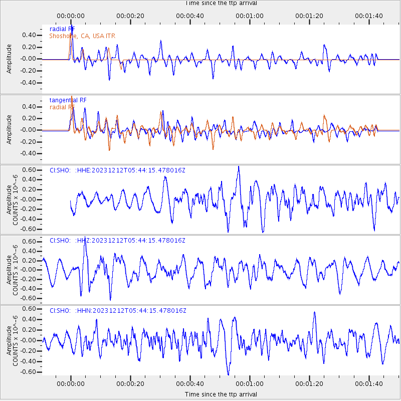
SHO Shoshone, CA, USA - Earthquake Result Viewer
*The percent match for this event was below the threshold and hence no stack was calculated.
| Earthquake location: |
Tonga Islands |
| Earthquake latitude/longitude: |
-15.2/-173.3 |
| Earthquake time(UTC): |
2023/12/12 (346) 05:33:10 GMT |
| Earthquake Depth: |
10 km |
| Earthquake Magnitude: |
5.7 mww |
| Earthquake Catalog/Contributor: |
NEIC PDE/us |
|
| Network: |
CI Caltech Regional Seismic Network |
| Station: |
SHO Shoshone, CA, USA |
| Lat/Lon: |
35.90 N/116.28 W |
| Elevation: |
451 m |
|
| Distance: |
74.0 deg |
| Az: |
45.077 deg |
| Baz: |
237.347 deg |
| Ray Param: |
$rayparam |
*The percent match for this event was below the threshold and hence was not used in the summary stack. |
|
| Radial Match: |
54.889122 % |
| Radial Bump: |
400 |
| Transverse Match: |
49.110195 % |
| Transverse Bump: |
400 |
| SOD ConfigId: |
33232451 |
| Insert Time: |
2023-12-26 05:43:36.616 +0000 |
| GWidth: |
2.5 |
| Max Bumps: |
400 |
| Tol: |
0.001 |
|
Signal To Noise
| Channel | StoN | STA | LTA |
| CI:SHO: :HHZ:20231212T05:44:15.478016Z | 1.9400377 | 2.5575414E-7 | 1.3182947E-7 |
| CI:SHO: :HHN:20231212T05:44:15.478016Z | 1.1572846 | 1.6733256E-7 | 1.4459067E-7 |
| CI:SHO: :HHE:20231212T05:44:15.478016Z | 2.4268942 | 2.892006E-7 | 1.191649E-7 |
| Arrivals |
| Ps | |
| PpPs | |
| PsPs/PpSs | |


