You are here: Home > Network List > TX - Texas Seismological Network Stations List
> Station WTFS Witchita Falls > Earthquake Result Viewer
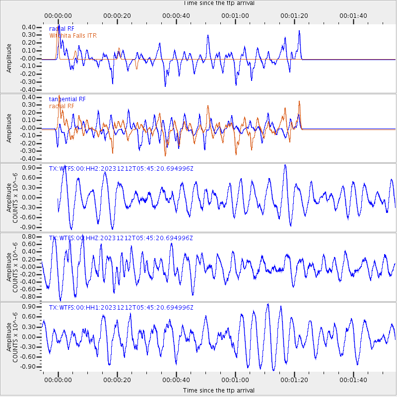
WTFS Witchita Falls - Earthquake Result Viewer
*The percent match for this event was below the threshold and hence no stack was calculated.
| Earthquake location: |
Tonga Islands |
| Earthquake latitude/longitude: |
-15.2/-173.3 |
| Earthquake time(UTC): |
2023/12/12 (346) 05:33:10 GMT |
| Earthquake Depth: |
10 km |
| Earthquake Magnitude: |
5.7 mww |
| Earthquake Catalog/Contributor: |
NEIC PDE/us |
|
| Network: |
TX Texas Seismological Network |
| Station: |
WTFS Witchita Falls |
| Lat/Lon: |
33.77 N/98.46 W |
| Elevation: |
277 m |
|
| Distance: |
86.2 deg |
| Az: |
53.673 deg |
| Baz: |
249.021 deg |
| Ray Param: |
$rayparam |
*The percent match for this event was below the threshold and hence was not used in the summary stack. |
|
| Radial Match: |
47.989758 % |
| Radial Bump: |
339 |
| Transverse Match: |
34.63851 % |
| Transverse Bump: |
301 |
| SOD ConfigId: |
33232451 |
| Insert Time: |
2023-12-26 05:53:51.653 +0000 |
| GWidth: |
2.5 |
| Max Bumps: |
400 |
| Tol: |
0.001 |
|
Signal To Noise
| Channel | StoN | STA | LTA |
| TX:WTFS:00:HHZ:20231212T05:45:20.694996Z | 2.72667 | 5.0533737E-7 | 1.8533133E-7 |
| TX:WTFS:00:HH1:20231212T05:45:20.694996Z | 0.41132125 | 1.5293881E-7 | 3.7182326E-7 |
| TX:WTFS:00:HH2:20231212T05:45:20.694996Z | 0.3396716 | 1.6128124E-7 | 4.7481515E-7 |
| Arrivals |
| Ps | |
| PpPs | |
| PsPs/PpSs | |


