You are here: Home > Network List > US - United States National Seismic Network Stations List
> Station HAWA Hanford, Washington, USA > Earthquake Result Viewer
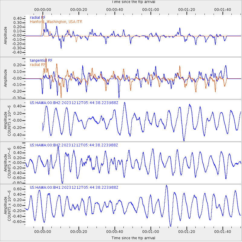
HAWA Hanford, Washington, USA - Earthquake Result Viewer
*The percent match for this event was below the threshold and hence no stack was calculated.
| Earthquake location: |
Tonga Islands |
| Earthquake latitude/longitude: |
-15.2/-173.3 |
| Earthquake time(UTC): |
2023/12/12 (346) 05:33:10 GMT |
| Earthquake Depth: |
10 km |
| Earthquake Magnitude: |
5.7 mww |
| Earthquake Catalog/Contributor: |
NEIC PDE/us |
|
| Network: |
US United States National Seismic Network |
| Station: |
HAWA Hanford, Washington, USA |
| Lat/Lon: |
46.39 N/119.53 W |
| Elevation: |
364 m |
|
| Distance: |
78.0 deg |
| Az: |
34.774 deg |
| Baz: |
232.709 deg |
| Ray Param: |
$rayparam |
*The percent match for this event was below the threshold and hence was not used in the summary stack. |
|
| Radial Match: |
52.1548 % |
| Radial Bump: |
284 |
| Transverse Match: |
38.50558 % |
| Transverse Bump: |
375 |
| SOD ConfigId: |
33232451 |
| Insert Time: |
2023-12-26 05:55:25.088 +0000 |
| GWidth: |
2.5 |
| Max Bumps: |
400 |
| Tol: |
0.001 |
|
Signal To Noise
| Channel | StoN | STA | LTA |
| US:HAWA:00:BHZ:20231212T05:44:38.223988Z | 0.8619567 | 1.7981368E-7 | 2.0861104E-7 |
| US:HAWA:00:BH1:20231212T05:44:38.223988Z | 2.6994653 | 3.7471054E-7 | 1.3880917E-7 |
| US:HAWA:00:BH2:20231212T05:44:38.223988Z | 0.27514964 | 6.440341E-8 | 2.3406685E-7 |
| Arrivals |
| Ps | |
| PpPs | |
| PsPs/PpSs | |


