You are here: Home > Network List > CI - Caltech Regional Seismic Network Stations List
> Station TIN Tinemaha, Big Pine, CA, USA > Earthquake Result Viewer
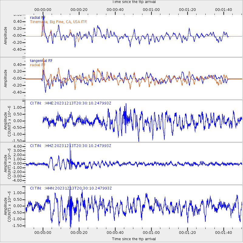
TIN Tinemaha, Big Pine, CA, USA - Earthquake Result Viewer
*The percent match for this event was below the threshold and hence no stack was calculated.
| Earthquake location: |
Norwegian Sea |
| Earthquake latitude/longitude: |
72.6/3.5 |
| Earthquake time(UTC): |
2023/12/13 (347) 20:20:10 GMT |
| Earthquake Depth: |
10 km |
| Earthquake Magnitude: |
5.5 mww |
| Earthquake Catalog/Contributor: |
NEIC PDE/us |
|
| Network: |
CI Caltech Regional Seismic Network |
| Station: |
TIN Tinemaha, Big Pine, CA, USA |
| Lat/Lon: |
37.05 N/118.23 W |
| Elevation: |
1197 m |
|
| Distance: |
63.6 deg |
| Az: |
310.527 deg |
| Baz: |
16.637 deg |
| Ray Param: |
$rayparam |
*The percent match for this event was below the threshold and hence was not used in the summary stack. |
|
| Radial Match: |
72.542244 % |
| Radial Bump: |
400 |
| Transverse Match: |
69.73246 % |
| Transverse Bump: |
400 |
| SOD ConfigId: |
33437571 |
| Insert Time: |
2023-12-27 20:32:22.554 +0000 |
| GWidth: |
2.5 |
| Max Bumps: |
400 |
| Tol: |
0.001 |
|
Signal To Noise
| Channel | StoN | STA | LTA |
| CI:TIN: :HHZ:20231213T20:30:10.247993Z | 3.7622895 | 6.4484954E-7 | 1.7139817E-7 |
| CI:TIN: :HHN:20231213T20:30:10.247993Z | 2.045034 | 4.4619213E-7 | 2.1818325E-7 |
| CI:TIN: :HHE:20231213T20:30:10.247993Z | 1.0652508 | 2.4732427E-7 | 2.3217468E-7 |
| Arrivals |
| Ps | |
| PpPs | |
| PsPs/PpSs | |


