You are here: Home > Network List > TA - USArray Transportable Network (new EarthScope stations) Stations List
> Station MSTX Muleshoe, TX, USA > Earthquake Result Viewer
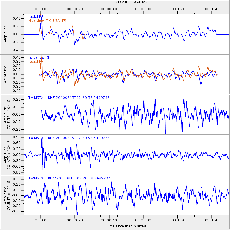
MSTX Muleshoe, TX, USA - Earthquake Result Viewer
*The percent match for this event was below the threshold and hence no stack was calculated.
| Earthquake location: |
Near East Coast Of Kamchatka |
| Earthquake latitude/longitude: |
53.6/160.1 |
| Earthquake time(UTC): |
2010/08/15 (227) 02:10:38 GMT |
| Earthquake Depth: |
40 km |
| Earthquake Magnitude: |
5.5 MB, 4.9 MS, 5.5 MW, 5.4 MW |
| Earthquake Catalog/Contributor: |
WHDF/NEIC |
|
| Network: |
TA USArray Transportable Network (new EarthScope stations) |
| Station: |
MSTX Muleshoe, TX, USA |
| Lat/Lon: |
33.97 N/102.77 W |
| Elevation: |
1167 m |
|
| Distance: |
67.4 deg |
| Az: |
63.325 deg |
| Baz: |
320.099 deg |
| Ray Param: |
$rayparam |
*The percent match for this event was below the threshold and hence was not used in the summary stack. |
|
| Radial Match: |
62.738903 % |
| Radial Bump: |
400 |
| Transverse Match: |
62.44836 % |
| Transverse Bump: |
400 |
| SOD ConfigId: |
319893 |
| Insert Time: |
2011-01-05 23:26:08.831 +0000 |
| GWidth: |
2.5 |
| Max Bumps: |
400 |
| Tol: |
0.001 |
|
Signal To Noise
| Channel | StoN | STA | LTA |
| TA:MSTX: :BHZ:20100815T02:20:58.549973Z | 4.601351 | 3.4562416E-7 | 7.5113626E-8 |
| TA:MSTX: :BHN:20100815T02:20:58.549973Z | 2.1021407 | 1.16900424E-7 | 5.5610183E-8 |
| TA:MSTX: :BHE:20100815T02:20:58.549973Z | 1.9245493 | 1.1261217E-7 | 5.8513525E-8 |
| Arrivals |
| Ps | |
| PpPs | |
| PsPs/PpSs | |


