You are here: Home > Network List > TA - USArray Transportable Network (new EarthScope stations) Stations List
> Station I19A Meeteetse, WY, USA > Earthquake Result Viewer
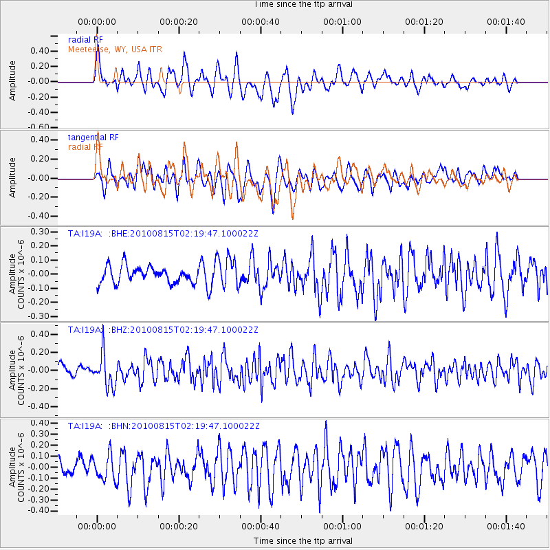
I19A Meeteetse, WY, USA - Earthquake Result Viewer
*The percent match for this event was below the threshold and hence no stack was calculated.
| Earthquake location: |
Near East Coast Of Kamchatka |
| Earthquake latitude/longitude: |
53.6/160.1 |
| Earthquake time(UTC): |
2010/08/15 (227) 02:10:38 GMT |
| Earthquake Depth: |
40 km |
| Earthquake Magnitude: |
5.5 MB, 4.9 MS, 5.5 MW, 5.4 MW |
| Earthquake Catalog/Contributor: |
WHDF/NEIC |
|
| Network: |
TA USArray Transportable Network (new EarthScope stations) |
| Station: |
I19A Meeteetse, WY, USA |
| Lat/Lon: |
44.04 N/108.99 W |
| Elevation: |
1982 m |
|
| Distance: |
56.7 deg |
| Az: |
59.653 deg |
| Baz: |
314.45 deg |
| Ray Param: |
$rayparam |
*The percent match for this event was below the threshold and hence was not used in the summary stack. |
|
| Radial Match: |
63.91518 % |
| Radial Bump: |
400 |
| Transverse Match: |
52.500835 % |
| Transverse Bump: |
400 |
| SOD ConfigId: |
319893 |
| Insert Time: |
2011-01-05 23:27:26.654 +0000 |
| GWidth: |
2.5 |
| Max Bumps: |
400 |
| Tol: |
0.001 |
|
Signal To Noise
| Channel | StoN | STA | LTA |
| TA:I19A: :BHZ:20100815T02:19:47.100022Z | 2.6352262 | 1.8777374E-7 | 7.1255265E-8 |
| TA:I19A: :BHN:20100815T02:19:47.100022Z | 1.872487 | 1.1913838E-7 | 6.362575E-8 |
| TA:I19A: :BHE:20100815T02:19:47.100022Z | 1.9547968 | 1.0952348E-7 | 5.6028064E-8 |
| Arrivals |
| Ps | |
| PpPs | |
| PsPs/PpSs | |


