You are here: Home > Network List > US - United States National Seismic Network Stations List
> Station AMTX Amarillo, Texas, USA > Earthquake Result Viewer
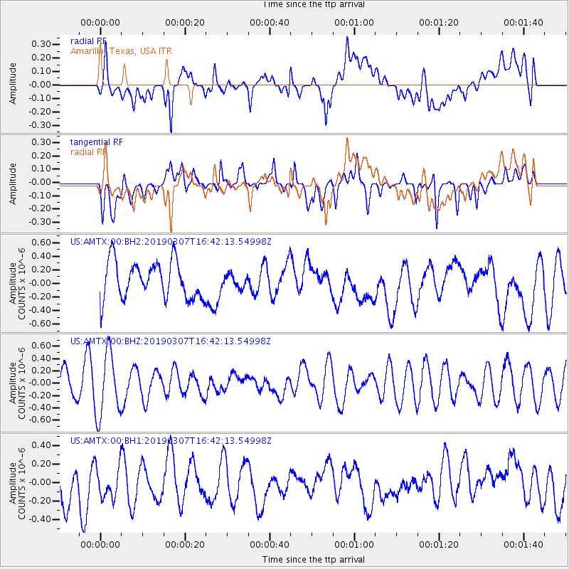
AMTX Amarillo, Texas, USA - Earthquake Result Viewer
*The percent match for this event was below the threshold and hence no stack was calculated.
| Earthquake location: |
South Of Kermadec Islands |
| Earthquake latitude/longitude: |
-32.5/-178.4 |
| Earthquake time(UTC): |
2019/03/07 (066) 16:29:09 GMT |
| Earthquake Depth: |
21 km |
| Earthquake Magnitude: |
5.7 Mww |
| Earthquake Catalog/Contributor: |
NEIC PDE/us |
|
| Network: |
US United States National Seismic Network |
| Station: |
AMTX Amarillo, Texas, USA |
| Lat/Lon: |
34.53 N/101.41 W |
| Elevation: |
1010 m |
|
| Distance: |
98.3 deg |
| Az: |
54.385 deg |
| Baz: |
236.336 deg |
| Ray Param: |
$rayparam |
*The percent match for this event was below the threshold and hence was not used in the summary stack. |
|
| Radial Match: |
36.56063 % |
| Radial Bump: |
400 |
| Transverse Match: |
54.498074 % |
| Transverse Bump: |
400 |
| SOD ConfigId: |
3338192 |
| Insert Time: |
2019-03-21 16:44:59.133 +0000 |
| GWidth: |
2.5 |
| Max Bumps: |
400 |
| Tol: |
0.001 |
|
Signal To Noise
| Channel | StoN | STA | LTA |
| US:AMTX:00:BHZ:20190307T16:42:13.54998Z | 2.1873531 | 5.179244E-7 | 2.3678133E-7 |
| US:AMTX:00:BH1:20190307T16:42:13.54998Z | 0.896338 | 1.8486111E-7 | 2.062404E-7 |
| US:AMTX:00:BH2:20190307T16:42:13.54998Z | 0.33266526 | 9.1494975E-8 | 2.7503614E-7 |
| Arrivals |
| Ps | |
| PpPs | |
| PsPs/PpSs | |


