You are here: Home > Network List > US - United States National Seismic Network Stations List
> Station DUG Dugway, Tooele County, Utah, USA > Earthquake Result Viewer
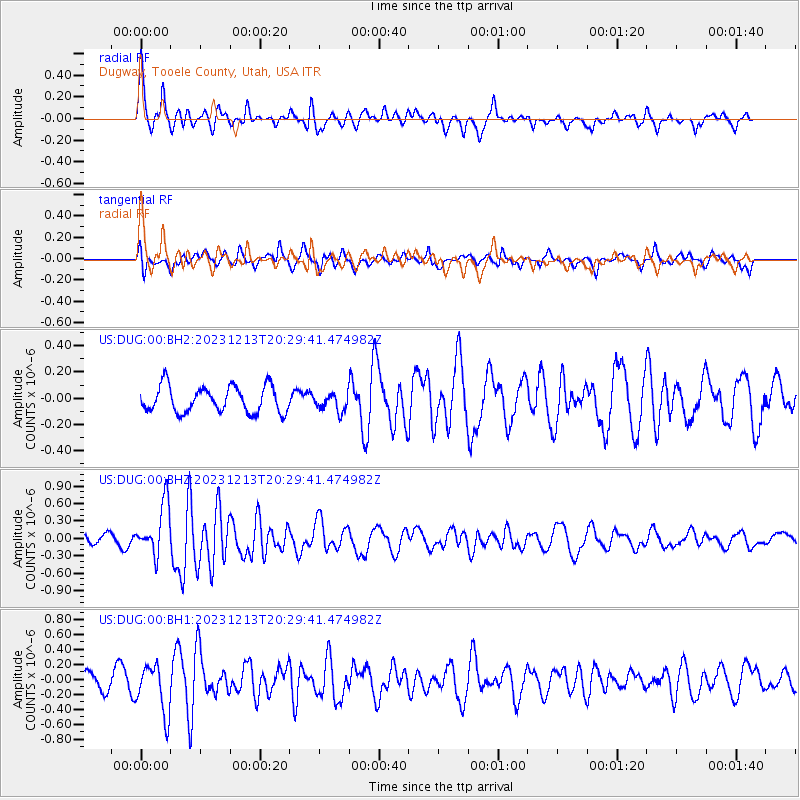
DUG Dugway, Tooele County, Utah, USA - Earthquake Result Viewer
*The percent match for this event was below the threshold and hence no stack was calculated.
| Earthquake location: |
Norwegian Sea |
| Earthquake latitude/longitude: |
72.6/3.5 |
| Earthquake time(UTC): |
2023/12/13 (347) 20:20:10 GMT |
| Earthquake Depth: |
10 km |
| Earthquake Magnitude: |
5.5 mww |
| Earthquake Catalog/Contributor: |
NEIC PDE/us |
|
| Network: |
US United States National Seismic Network |
| Station: |
DUG Dugway, Tooele County, Utah, USA |
| Lat/Lon: |
40.19 N/112.81 W |
| Elevation: |
1477 m |
|
| Distance: |
59.3 deg |
| Az: |
306.991 deg |
| Baz: |
18.314 deg |
| Ray Param: |
$rayparam |
*The percent match for this event was below the threshold and hence was not used in the summary stack. |
|
| Radial Match: |
66.28316 % |
| Radial Bump: |
400 |
| Transverse Match: |
59.19565 % |
| Transverse Bump: |
400 |
| SOD ConfigId: |
33437571 |
| Insert Time: |
2023-12-27 20:52:14.392 +0000 |
| GWidth: |
2.5 |
| Max Bumps: |
400 |
| Tol: |
0.001 |
|
Signal To Noise
| Channel | StoN | STA | LTA |
| US:DUG:00:BHZ:20231213T20:29:41.474982Z | 4.7447343 | 4.3931064E-7 | 9.258909E-8 |
| US:DUG:00:BH1:20231213T20:29:41.474982Z | 3.0377111 | 3.2881422E-7 | 1.08244066E-7 |
| US:DUG:00:BH2:20231213T20:29:41.474982Z | 0.67818123 | 6.7392016E-8 | 9.93717E-8 |
| Arrivals |
| Ps | |
| PpPs | |
| PsPs/PpSs | |


