You are here: Home > Network List > UW - Pacific Northwest Regional Seismic Network Stations List
> Station UMAT Pilot Rock, OR, USA > Earthquake Result Viewer
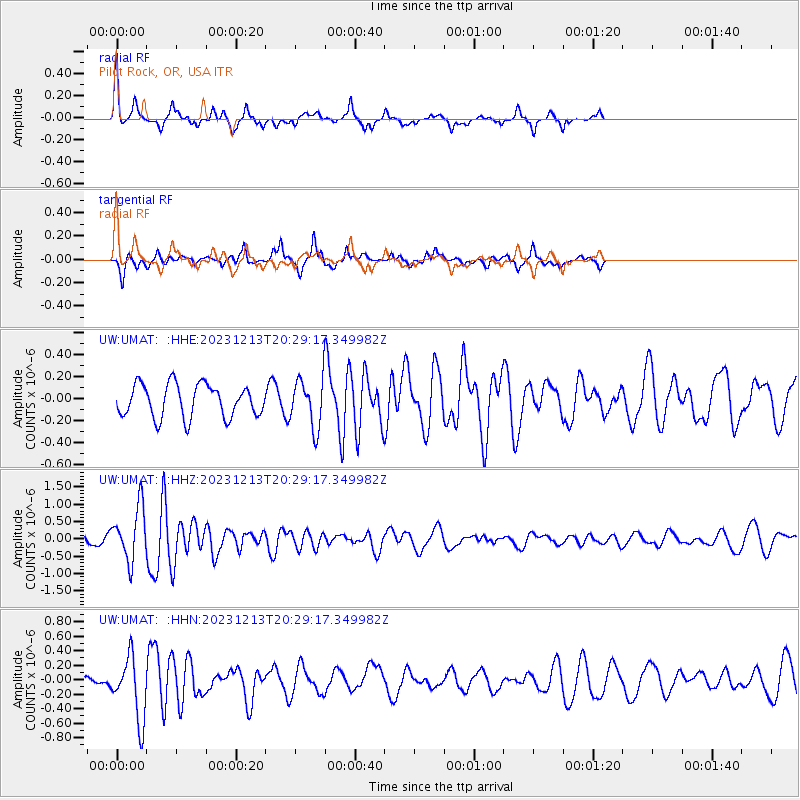
UMAT Pilot Rock, OR, USA - Earthquake Result Viewer
*The percent match for this event was below the threshold and hence no stack was calculated.
| Earthquake location: |
Norwegian Sea |
| Earthquake latitude/longitude: |
72.6/3.5 |
| Earthquake time(UTC): |
2023/12/13 (347) 20:20:10 GMT |
| Earthquake Depth: |
10 km |
| Earthquake Magnitude: |
5.5 mww |
| Earthquake Catalog/Contributor: |
NEIC PDE/us |
|
| Network: |
UW Pacific Northwest Regional Seismic Network |
| Station: |
UMAT Pilot Rock, OR, USA |
| Lat/Lon: |
45.29 N/118.96 W |
| Elevation: |
1318 m |
|
| Distance: |
55.9 deg |
| Az: |
313.963 deg |
| Baz: |
17.895 deg |
| Ray Param: |
$rayparam |
*The percent match for this event was below the threshold and hence was not used in the summary stack. |
|
| Radial Match: |
72.085014 % |
| Radial Bump: |
344 |
| Transverse Match: |
60.89339 % |
| Transverse Bump: |
359 |
| SOD ConfigId: |
33437571 |
| Insert Time: |
2023-12-27 20:55:30.462 +0000 |
| GWidth: |
2.5 |
| Max Bumps: |
400 |
| Tol: |
0.001 |
|
Signal To Noise
| Channel | StoN | STA | LTA |
| UW:UMAT: :HHZ:20231213T20:29:17.349982Z | 4.0791125 | 7.697675E-7 | 1.8870956E-7 |
| UW:UMAT: :HHN:20231213T20:29:17.349982Z | 2.8467464 | 4.393167E-7 | 1.543224E-7 |
| UW:UMAT: :HHE:20231213T20:29:17.349982Z | 1.4629492 | 2.1647811E-7 | 1.4797378E-7 |
| Arrivals |
| Ps | |
| PpPs | |
| PsPs/PpSs | |


