You are here: Home > Network List > US - United States National Seismic Network Stations List
> Station WMOK Wichita Mountains, Oklahoma, USA > Earthquake Result Viewer
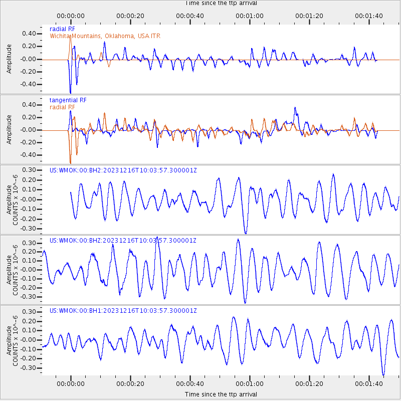
WMOK Wichita Mountains, Oklahoma, USA - Earthquake Result Viewer
*The percent match for this event was below the threshold and hence no stack was calculated.
| Earthquake location: |
Mariana Islands |
| Earthquake latitude/longitude: |
20.3/145.7 |
| Earthquake time(UTC): |
2023/12/16 (350) 09:50:53 GMT |
| Earthquake Depth: |
10 km |
| Earthquake Magnitude: |
5.7 mww |
| Earthquake Catalog/Contributor: |
NEIC PDE/us |
|
| Network: |
US United States National Seismic Network |
| Station: |
WMOK Wichita Mountains, Oklahoma, USA |
| Lat/Lon: |
34.74 N/98.78 W |
| Elevation: |
486 m |
|
| Distance: |
97.9 deg |
| Az: |
48.618 deg |
| Baz: |
301.199 deg |
| Ray Param: |
$rayparam |
*The percent match for this event was below the threshold and hence was not used in the summary stack. |
|
| Radial Match: |
58.490326 % |
| Radial Bump: |
400 |
| Transverse Match: |
54.740974 % |
| Transverse Bump: |
400 |
| SOD ConfigId: |
33437571 |
| Insert Time: |
2023-12-30 10:16:15.077 +0000 |
| GWidth: |
2.5 |
| Max Bumps: |
400 |
| Tol: |
0.001 |
|
Signal To Noise
| Channel | StoN | STA | LTA |
| US:WMOK:00:BHZ:20231216T10:03:57.300001Z | 0.4148931 | 6.514371E-8 | 1.5701325E-7 |
| US:WMOK:00:BH1:20231216T10:03:57.300001Z | 1.0543406 | 1.03711805E-7 | 9.8366506E-8 |
| US:WMOK:00:BH2:20231216T10:03:57.300001Z | 0.5484404 | 6.2934724E-8 | 1.14752176E-7 |
| Arrivals |
| Ps | |
| PpPs | |
| PsPs/PpSs | |


